This was our first time to the Grand Canyon and we now understand why it’s so popular. Every time we looked at the canyon it was slightly different but still amazing. We arrived in the early afternoon of Monday and left mid-morning on Friday, which gave us plenty of time. We stayed at the Trailer Village on the South Rim.

Another view with different lighting.
We had an early dinner on our first night so we could be in time for the sunset. We made sure our bikes were fitted with their lights and rode ten minutes on a paved “Greenway” trail to the Visitor Centre. From there it was another ten minutes walking to Mather Point.
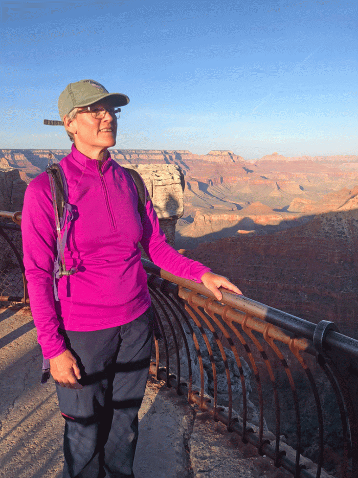
Here’s one of several photos we took as the sun was descending.

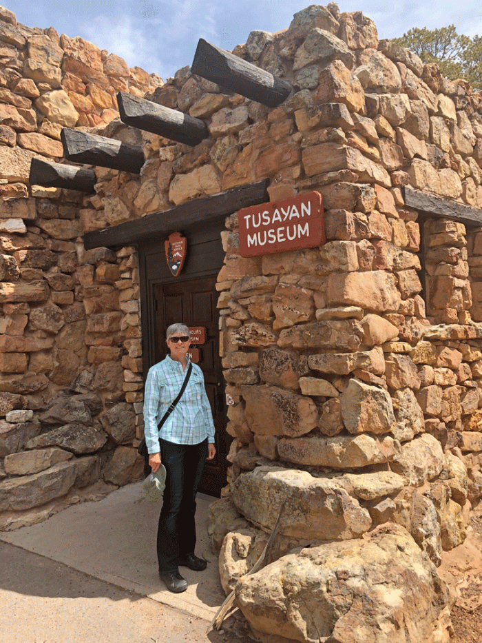
The next day was an acclimatization day, to allow us to be able to breathe easier at elevation. We took a road tour east along the rim road, towards the east entrance to the park. The Tusayan museum, although small, was very interesting because there were displays from each of the indigenous peoples that have the Grand Canyon as a prominent place in their culture.
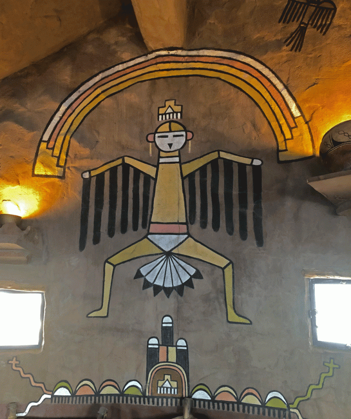
The Desert View Watchtower is near the east entrance. It was built in 1932 by architect Mary Colter, who designed many of the early buildings on the south rim. Although it looks like it is made only of stone, it was built on the steel skeleton.
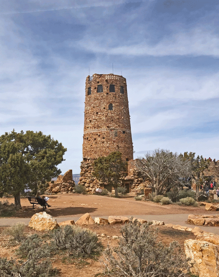
Mary based the interiors on native art that she had seen.

You can climb the steps to almost the top of the tower and view the motifs on the plaster walls. There was also an outside viewing platform that gave you a different view of the canyon. Unfortunately, like many days at the Grand Canyon the air was hazy from pollution that blows in from Southern California.
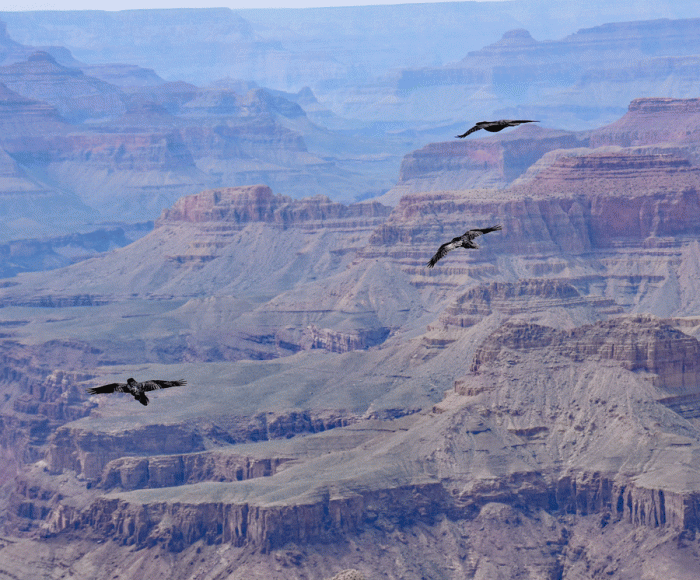
We stopped at every overlook on the way back. At one of them, Doug was quick enough to catch these ravens soaring at almost the same level as us.
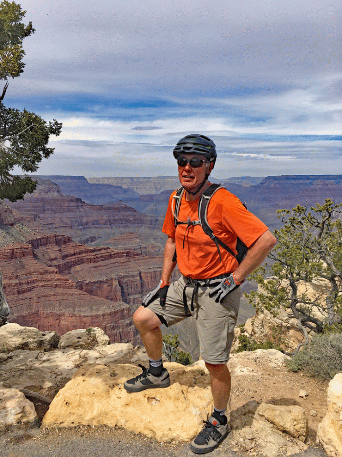
The next day we rode our bikes on the Greenway trails to the start of the Hermit Road. This road is only open to the shuttle buses and service vehicles so there wasn’t much traffic. It was another hazy, cloudy day but we got to see some different views of the canyon.
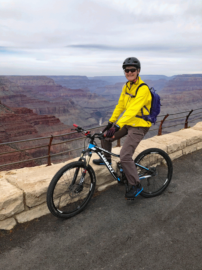
There was a section of Greenway trail close to the end of the road which was really nice and had small pullouts for views like the one below. That day we rode about 33 kilometres, all on pavement thankfully.
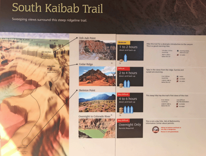
The next day was the one we were working up to: a hike below the rim. The difference with most hikes that we do was that it starts with the easy downhill part and ends with the uphill. We knew we could walk five hours but we were very conscious of the advice: “Downhill is optional, uphill is mandatory.” We studied the board and prepared ourselves for a big day, which means making our lunch at night, getting our packs organized and setting our alarm.
We rode our bikes to the trailhead instead of taking the shuttle bus, which was a nice half hour warm-up, and some of it was along a trail right beside the canyon.
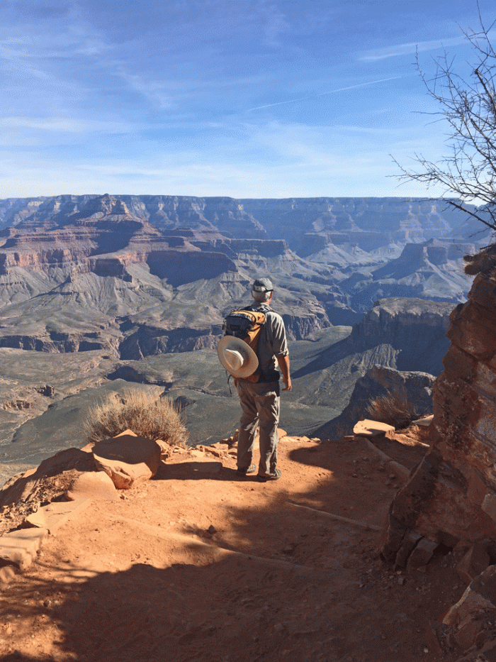
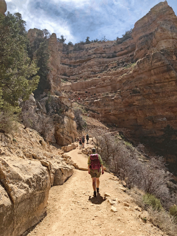
The views started right from the beginning of the South Kaibab trail. Here’s a spot about 15 minutes into the hike where the trail seems to drop into nothingness, but it actually takes a sharp switchback turn.
It was a well maintained and relatively smooth trail and we were at Ooh Aah Point in about twenty minutes. We continued downwards.
From Ooh Aah Point to Cedar Ridge took us another 25 minutes. It was too early to start back, so we kept going down. Here’s Wendy at Cedar Ridge. You can just make out the trail to Skeleton Point to the right.

Most of the people we saw on the trail below Cedar Ridge were backpacking to the river. We took a photo of a young couple and they took ours. This is the view looking west.
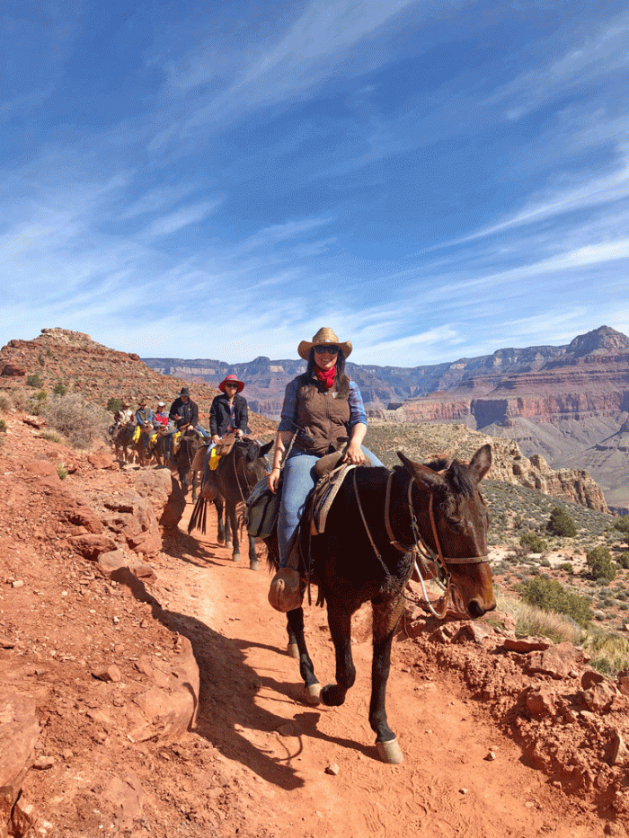
We met a mule train. The mules are fine with people on the edge of the trail as long as you are on the uphill side of them.
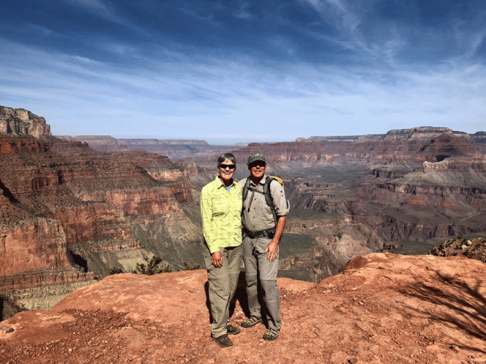
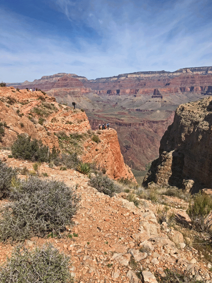
This is the view from Skeleton Point. The trail drops steeply from here, so it was a good turnaround point. It was only 10:30, but we had our lunch anyway.
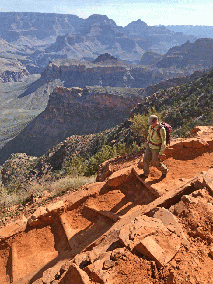
We headed upwards, and upwards. It wasn’t too bad because we just kept slowly walking. You can see the last steep section switchbacking ahead of Wendy. It looked worse that it was, because we were at the top within 20 minutes of this photo being taken.
It took us 2 1/2 hours to climb up, including rest stops, for a total of about 4 1/2 hours for the whole hike. Luckily our bike ride back to the trailer was mostly downhill.
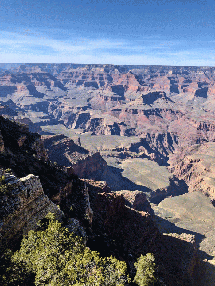
By Friday, we had seen more of the Grand Canyon than we had expected, but we didn’t have to leave early, so we took one last trip to the rim. The air was much clearer than the other days. So here’s another view from close to Mather Point.

Next stop is to Blanding, Utah to explore ruins and hike on slick rock.

The canyon is so beautiful. It is one of those places that no matter how many pictures you have seen…the real thing is still so much more impressive.
LikeLike