Moab, Utah

Moab, Utah

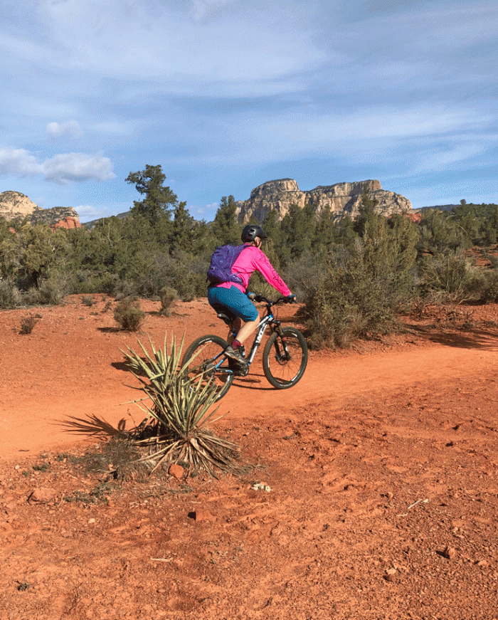
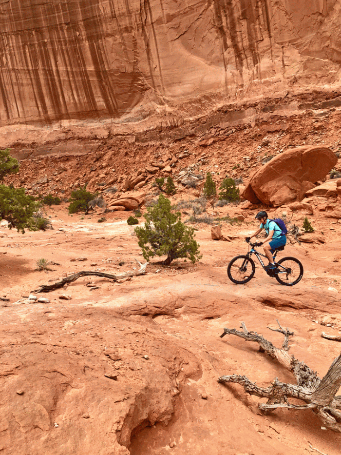
We wanted to ride and hike on slick rock on our visit to Moab and we had lots of opportunities. Our first mountain bike ride was up at Dead Horse State Park, in the Intrepid trail system. We had a cool day with a few rain sprinkles, but it was a perfect temperature for riding.

Wendy_Intrepid-trails

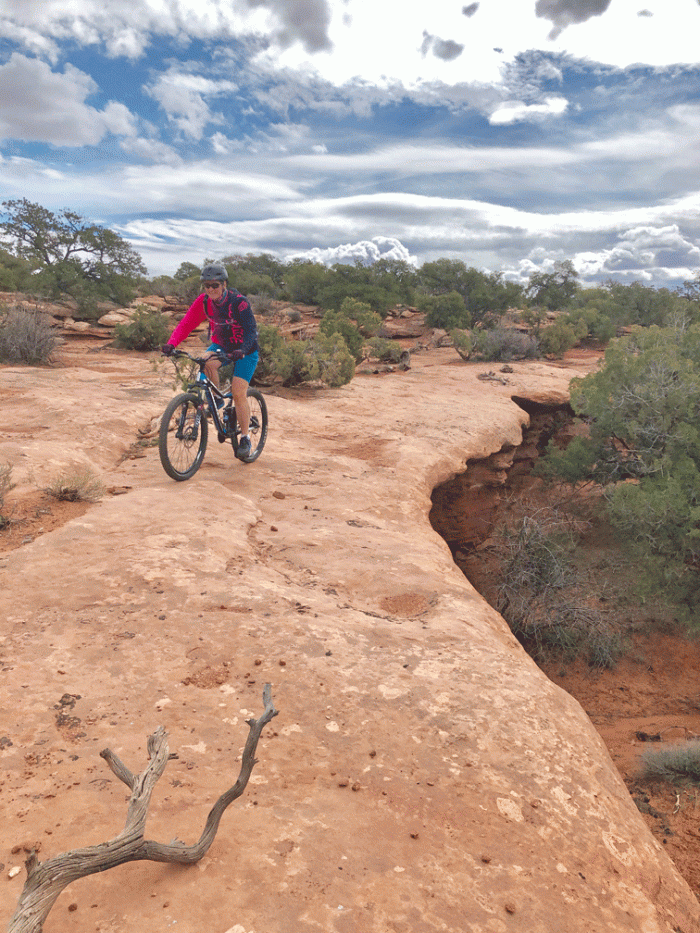
The trail went close to the edge of Schafer Canyon. Canyonlands National Park: Island in the Sky Unit is in the background of the photo below. We both had our “best day ever” of mountain biking. The trails had enough slick rock to be interesting and nothing too steep.

Wendy_slickrock-on-Intrepid-trails

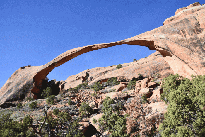
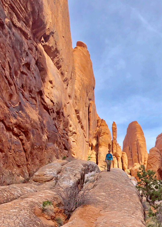
The next day, we headed to Devils Garden, one of our favourite hikes in Arches National Park. We chose to do the long loop, and view all ten arches. The trail to Landscape Arch is wide and smooth and very popular.

Landscape-Arch

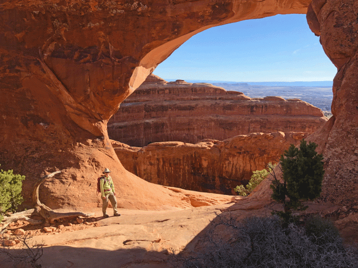
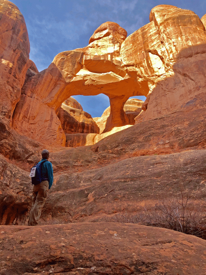
It was our first visit to Partition Arch. When we did the hike in 2016, we did the loop without any side trips because we didn’t have the same fitness level that we have now. We also took a side trip to Navaho Arch and to the viewpoint for Dark Arch.

Wendy_Partition-Arch

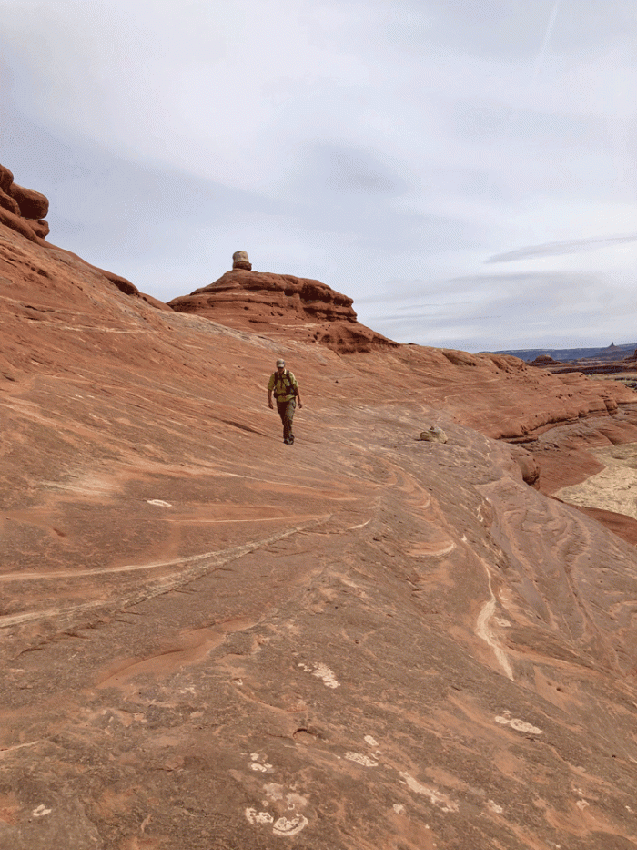
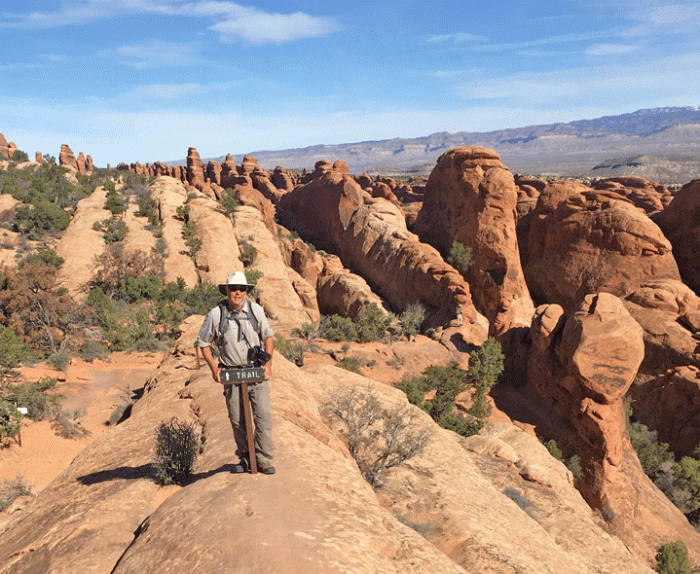
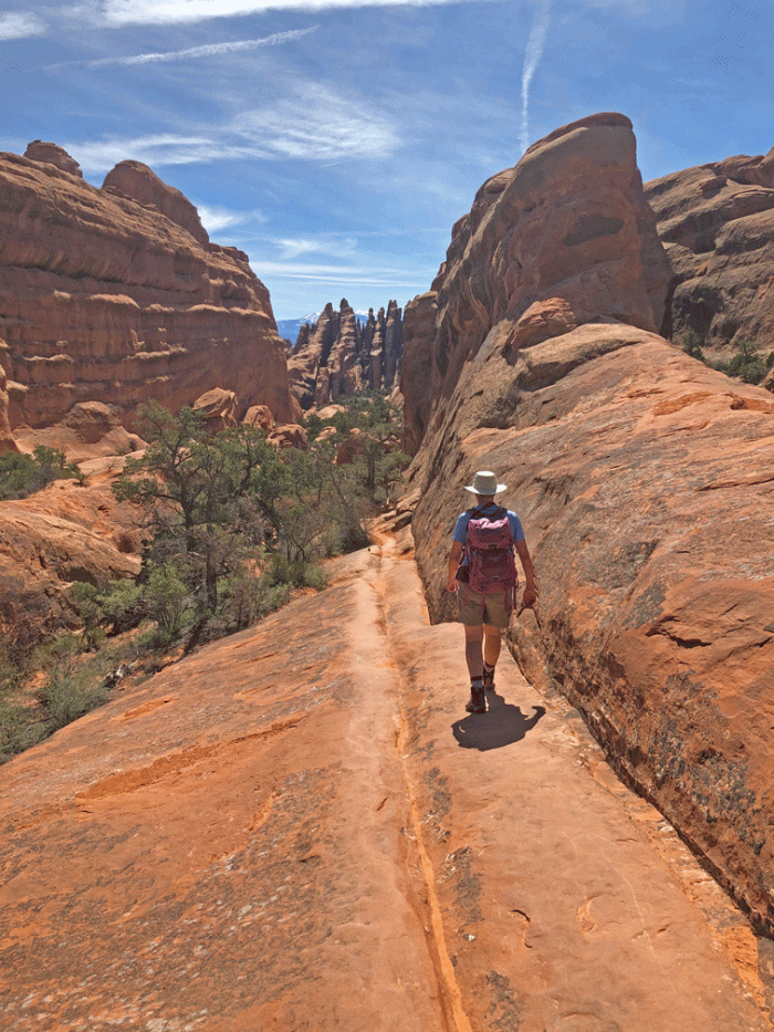
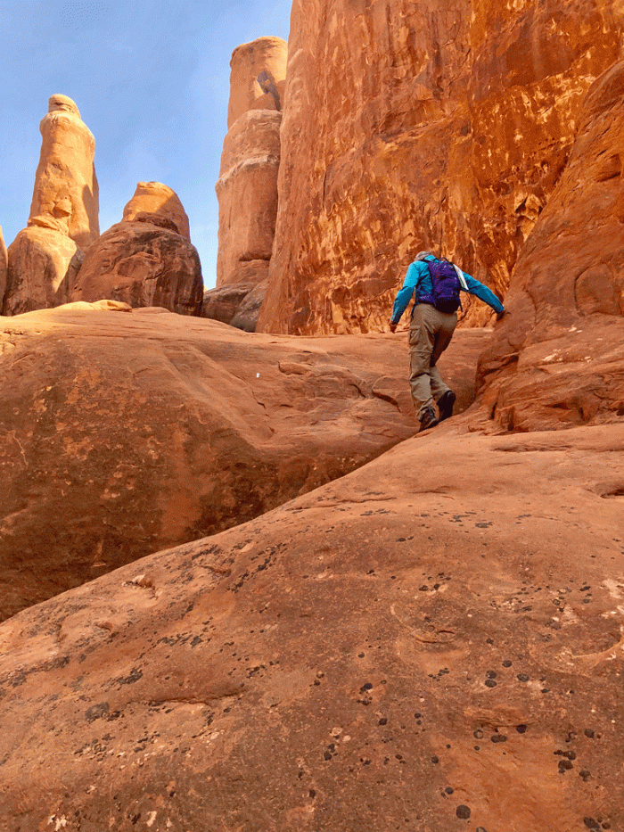
Most people turn around at Landscape Arch because the trail beyond it involves walking on slick rock and a bit of scrambling. The trail had more markers than the last time we walked it. Here’s Doug standing on the trail that goes along a sandstone rib. There was another sign further along to lead you to the exit to the left.

Doug_Double-O-hike

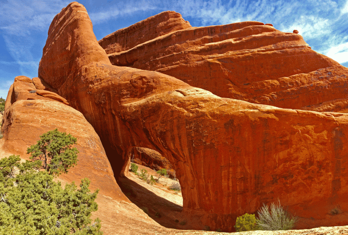
We reached Double O Arch and climbed up and through the bottom arch, to get this view. By this time, we’d been hiking two hours, so it was a good spot for a snack.

Double-O-Arch

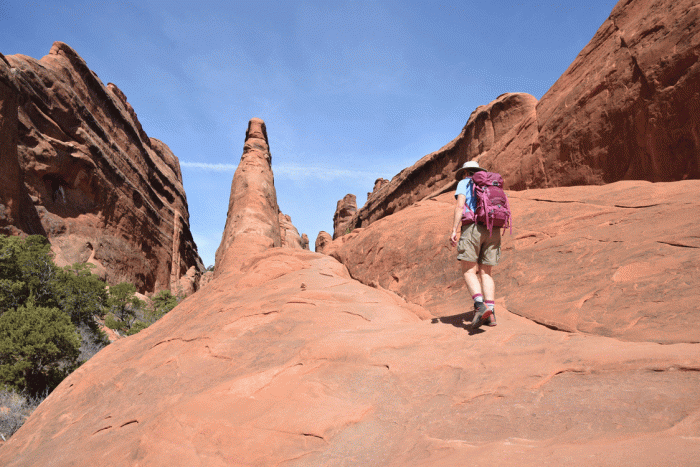
Following the primitive trail past Double O, we took another side trip to Private Arch.

Private-Arch

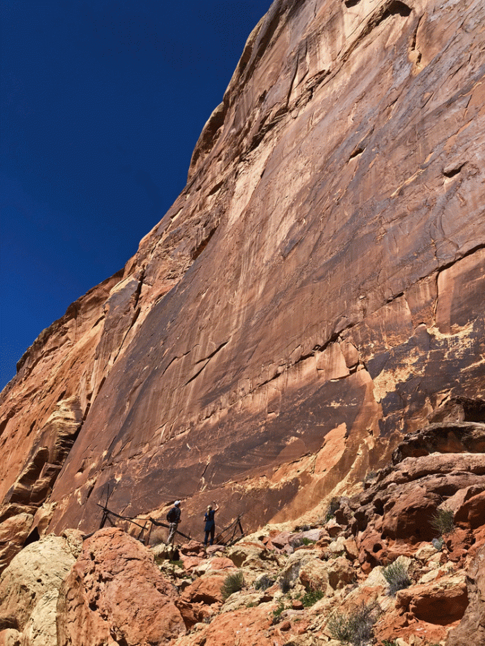
The primitive trail involves plenty of slick rock sections. You can pick out the trail by looking at the worn sections on the rock.

Wendy_Primitive-trail

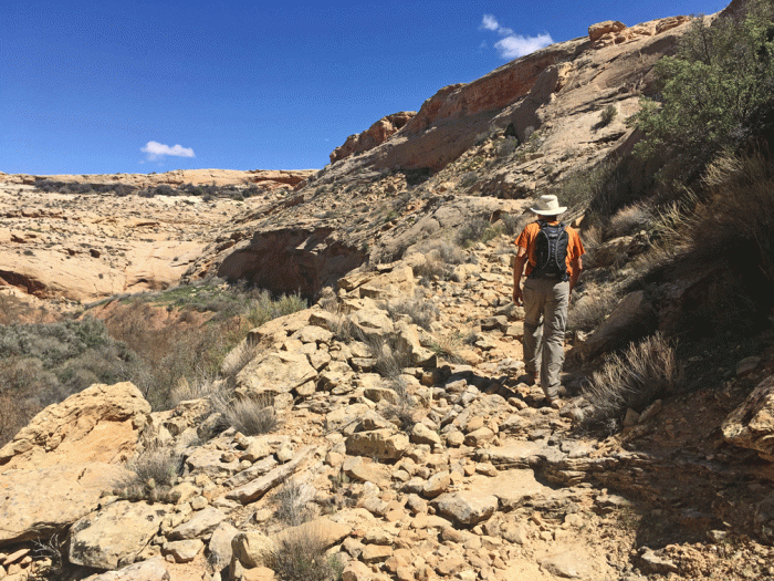
Here’s another section of the primitive trail.

Primitive-trail

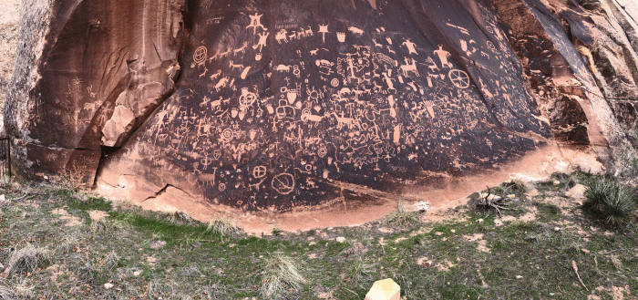
We took another side trip to a backcountry camping spot to have our lunch. It wasn’t much, just a relatively flat piece of rock.

We finally joined the main trail after climbing up from a wash. We took our final side trips to Pine Tree Arch and Tunnel Arch, then continued to the parking lot. Our total hike was just over 16 km and it took us just over 5 hours.

The next day, we hiked into the Fiery Furnace. You need a permit to hike in this area, and you are required to watch a video and have a chat with a ranger about the rules. The rules were basically to not harm the environment and to stay quiet to allow others to have a “wild” experience. There are no real trails but there are a few markers along the way. When we did the hike three years ago, there were no markers so it made it much more challenging.

Here’s Doug walking in a wash so you can get a sense of the scale. It’s a labyrinth of pillars and fins.

FF_Doug-walking

One of the “Dead End Ahead” areas leads to what we call “Surprise Arch.”

FF_-Surprise-Arch

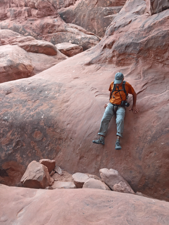
There’s lots of scrambling.

FF_Wendy-scrambling

Here’s Doug ready to climb up.

FF_doug-Scrambling

Canyoneering has different techniques than regular climbing. “Bum sliding” is an accepted practice and the only way down sometimes.

FF_Doug-bumsliding

Because we had hiked here before, we could explore the other “off-shoots” without stress. This photo was taken on our way back to the regular route.

FF_Wendy-on-fin

This slot is part of the regular route and was not very wide.

FF_Wendy-squeeze-crack

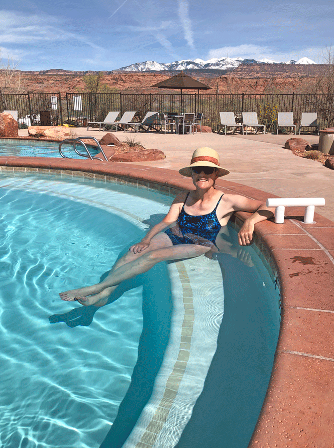
We spent about 3 enjoyable hours in the “Furnace.” That gave us time to get home early and lounge at the pool. The Moab KOA has really upgraded recently.

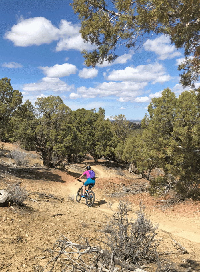
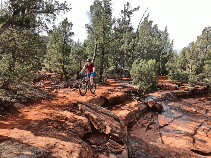
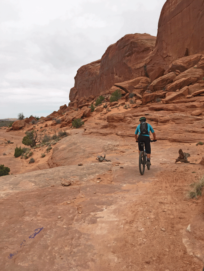
The next day we drove up towards Dead Horse State Park and stopped at the trailhead for Navaho Rocks. This is a newer mountain biking area with lots of slick rock and lots of elevation changes. We chose to ride up Big Mesa to Big Lonely. Wendy chose to ride the highway back to the parking lot and Doug continued to Coney Islands and Middle Earth. If we ever ride it again, we’d do it in the opposite direction.

Navajo-Rocks-trail-sign

Here’s Wendy near the beginning of Big Mesa.

Wendy_Big-Mesa

Here’s Doug on Big Mesa as well. You can see the route markers in the bottom of the photo; for Big Mesa it’s a blue stripe of paint. The juniper branches also help to define the route.

Doug_Big-Mesa

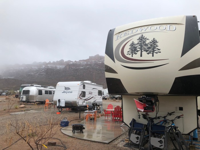
The wind picked up while we were riding and blew hard all evening. The next day, the cold front brought rain and snow and much lower temperatures. Just so you can see that our whole trip hasn’t been the sunshine and fine weather that most of our photos show, here’s a view of our site that day. It rained and sleeted most of the day. But we were warm and cosy and didn’t mind the rest.

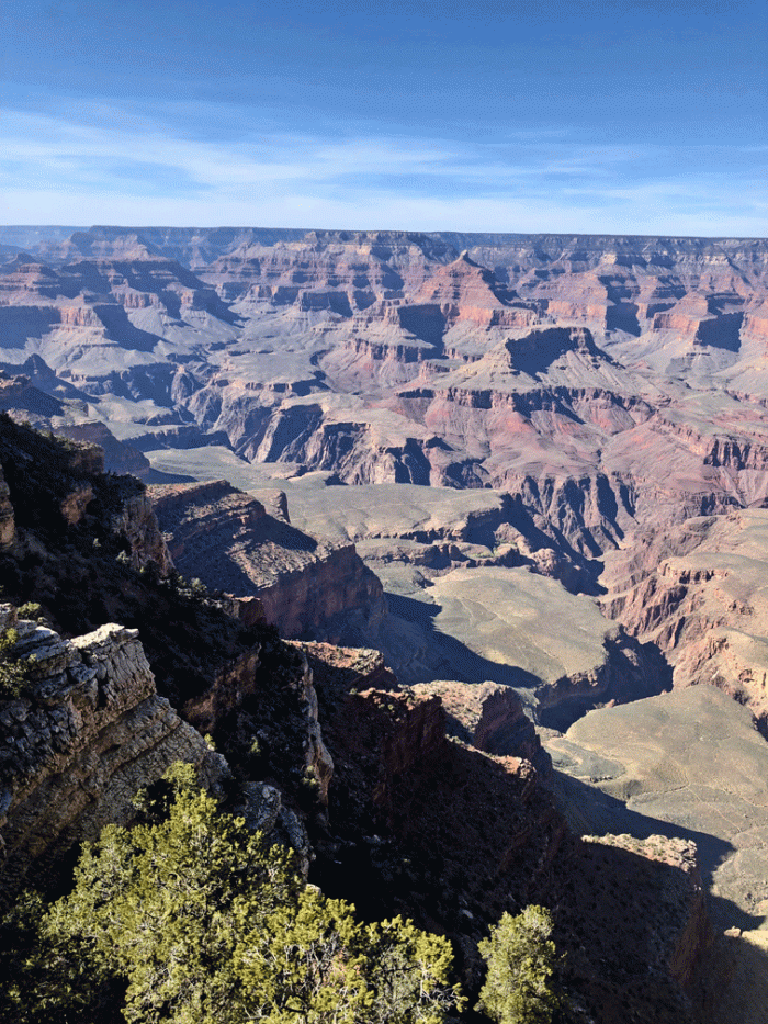
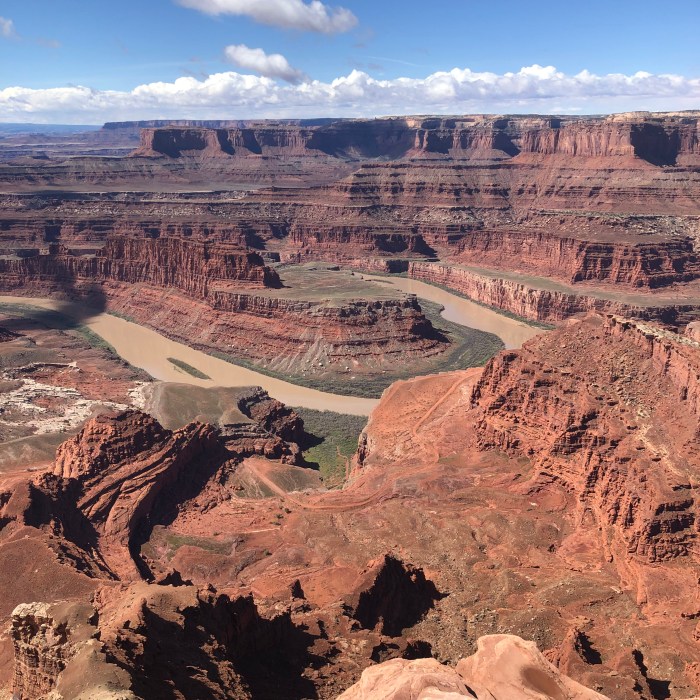
The weather improved for our last day in Moab. We drove up to Dead Horse State Park and Canyonlands National Park: Islands in the Sky Unit and stopped at most of the overlooks. Here’s a view from Dead Horse State Park down to the Colorado River.

So we’ll be on our way home. We expect to post again in July about our next trip. This trip was the longest we’ve ever done… so far…

Goodbye for now from “Travels with a Fox.” Perhaps it is more appropriate to say “foxes.” Here’s our mascots all in one spot of our Redwood Fifth Wheel.

Foxes

Blanding, UT: Anything but bland

Blanding, UT: Anything but bland

We stayed for a week at Blue Mountain RV in Blanding, Utah. Blanding is a perfect spot to stay to access the hiking trails to ruins and petroglyphs in the vicinity of Comb Ridge. Our site was at the upper level with good views over to the Bears Ears and to Monument Valley. We had a few nice sunsets, too.

Blanding-sunset

The first hike we did was to a wall of petroglyphs beside the San Juan River.

San-Juan-wall

There were hundreds of petroglyphs; some faded and some very clear, like this lizard-like creature.

Butler-petroglyh

The trail went down from the slick rock parking lot (at about the same level as the highway) via an old wagon road into Butler Wash. The map labelled it as “Emigrant Road” and we could see the grooves in the sandstone from wagon wheels. The road traverses the slope at about the level of Doug’s hat and if you look carefully you can see the rocks that were placed to make the trail wide enough for a wagon.

Doug_wagon-road

The next day we went back to Lower Butler Wash. To get to this ruin we had to route find and down climb. We thought we wouldn’t have trouble getting back up because we knew that it is usually harder to climb down than up. This ruin was in a natural alcove on a bench above the wash.

Hobbs-Wash-ruin2

It had “moki” steps, which are depressions that have been made in the rocks to allow a foothold. They didn’t seem to have a purpose unless they were to access a roof of a structure that is now long gone. Perhaps they were a sort of practice climbing wall for children, we’ll never know.

Ruins-moki-steps

The next day, we went in search of the “Big Crane” petroglyph. We’d seen pictures of it and every time we came to some petroglyphs we’d search the wall for it. But we hadn’t yet seen it in person. When we were at the San Juan panel, we talked to some other hikers who gave us a lead about where to find the crane.

Once we parked in the right spot, the trail was fairly straightforward, but we walked past the crane anyway. Backtracking, we used binoculars to scan the cliffs above, and picked it out, all by itself. We made our way up the ramp, and soon we were beside it.

Wendy_Crane

Here’s a closer view of the “Big Crane,” likely a rendition of a Sandhill crane.

Crane-closeup

We were back at the truck before noon, so we drove a couple of miles to a trailhead for Double Stack ruin. Along the trail were the remains of a Navaho sweat lodge.

Sweat-lodge

The ruin had numerous handprints high on the wall. Maybe the people who put them there were standing on the roof of a structure?

Handprints

After a rest day, we set out for Canyonlands National Park: Needles section. This part of the park is a pretty long drive from any nearby city, so we hadn’t visited it yet, but we were intrigued. So we got up early and drove the hour and a half to the trailhead at Squaw Flats Campground.

Here’s the first bluff that we climbed up and over on the Big Springs Canyon trail.

Start-of-hike

We could just see the tops of the Needles in the distance.

Big-Spring-Canyon-Needles

Soon we were at the head of the canyon and following the cairned route to the saddle in order to continue to Squaw Canyon. We worked our way up ledges and across this wet spot.

Wendy_spring-creek-ledge

From below, it didn’t look like there was a way up. Here’s a photo of Wendy working her way up the passageway. The sandstone was quite “grippy,” so it was a series of friction moves.

Wendy-ascent

Soon we could walk up it.

Doug-ascending-Spring-Creek

Here’s a view of Big Spring Canyon from near the top of the saddle.

Wendy_view-of-Spring-Creek

Then we had to go down into Squaw Canyon! But it wasn’t quite as steep as the other side. It was a bit like walking on a slanted sidewalk, and we worked our way down by picking the flattest places to put our feet.

Wendy-descent-traverse

The rest of the hike on the rock ledges was pretty straightforward, although there was a sort of a rock slot that Wendy had to work up the courage to jump across.

Leap-of-faith

Soon we were off the rock and on a regular trail again. We found a spot for an early lunch, then continued on, reaching the trailhead by 1:30, making it a 4 1/2 hour hike of 12 kilometres.

On our way back to Blanding, we stopped at the famous “Newspaper Rock.” There are hundreds of figures pecked into the rock. Most of the figures are Anasazi, however some Fremont and modern Ute figures occur.

Newspaper-rock

We hadn’t done any mountain biking for awhile and we were missing it a bit. So we drove just over an hour to Cortez, Colorado to one of our favourite mountain biking trails at Phil’s World. The trail has some challenging (but doable) uphill and some amazing downhill sections. Doug especially likes “The Ribcage,” a series of roller coaster-like whoops.

Phil's

After our ride, we checked out a newer brewery in Cortez: Wild Edge.

WildEdge

Blanding is a fairly quiet (and dry) community, but their motto is: Base camp to Adventure, and for us it was a great base camp for our adventures.

We have one more destination on our agenda: Moab, Utah. More mountain biking and hiking to come!

Grand Canyon, AZ

Grand Canyon, AZ

This was our first time to the Grand Canyon and we now understand why it’s so popular. Every time we looked at the canyon it was slightly different but still amazing. We arrived in the early afternoon of Monday and left mid-morning on Friday, which gave us plenty of time. We stayed at the Trailer Village on the South Rim.

Overlook_Bright-Angel

Another view with different lighting.

Overlook2

We had an early dinner on our first night so we could be in time for the sunset. We made sure our bikes were fitted with their lights and rode ten minutes on a paved “Greenway” trail to the Visitor Centre. From there it was another ten minutes walking to Mather Point.

Wendy_sunset

Here’s one of several photos we took as the sun was descending.

sunset

The next day was an acclimatization day, to allow us to be able to breathe easier at elevation. We took a road tour east along the rim road, towards the east entrance to the park. The Tusayan museum, although small, was very interesting because there were displays from each of the indigenous peoples that have the Grand Canyon as a prominent place in their culture.

Tusayan

The Desert View Watchtower is near the east entrance. It was built in 1932 by architect Mary Colter, who designed many of the early buildings on the south rim. Although it looks like it is made only of stone, it was built on the steel skeleton.

Watchtower

Mary based the interiors on native art that she had seen.

Watchtower-graphic1

You can climb the steps to almost the top of the tower and view the motifs on the plaster walls. There was also an outside viewing platform that gave you a different view of the canyon. Unfortunately, like many days at the Grand Canyon the air was hazy from pollution that blows in from Southern California.

Watchtower-Graphic2

We stopped at every overlook on the way back. At one of them, Doug was quick enough to catch these ravens soaring at almost the same level as us.

Ravens

The next day we rode our bikes on the Greenway trails to the start of the Hermit Road. This road is only open to the shuttle buses and service vehicles so there wasn’t much traffic. It was another hazy, cloudy day but we got to see some different views of the canyon.

Wendy_bike

There was a section of Greenway trail close to the end of the road which was really nice and had small pullouts for views like the one below. That day we rode about 33 kilometres, all on pavement thankfully.

Doug_bike-ride

The next day was the one we were working up to: a hike below the rim. The difference with most hikes that we do was that it starts with the easy downhill part and ends with the uphill. We knew we could walk five hours but we were very conscious of the advice: “Downhill is optional, uphill is mandatory.” We studied the board and prepared ourselves for a big day, which means making our lunch at night, getting our packs organized and setting our alarm.

Kaibab-Trail-sign

We rode our bikes to the trailhead instead of taking the shuttle bus, which was a nice half hour warm-up, and some of it was along a trail right beside the canyon.

The views started right from the beginning of the South Kaibab trail. Here’s a spot about 15 minutes into the hike where the trail seems to drop into nothingness, but it actually takes a sharp switchback turn.

Doug_Kaibab

It was a well maintained and relatively smooth trail and we were at Ooh Aah Point in about twenty minutes. We continued downwards.

Wendy_steps

From Ooh Aah Point to Cedar Ridge took us another 25 minutes. It was too early to start back, so we kept going down. Here’s Wendy at Cedar Ridge. You can just make out the trail to Skeleton Point to the right.

Wendy_Cedar-ridge

Most of the people we saw on the trail below Cedar Ridge were backpacking to the river. We took a photo of a young couple and they took ours. This is the view looking west.

Doug-and-Wendy

We met a mule train. The mules are fine with people on the edge of the trail as long as you are on the uphill side of them.

Mule-train

This is the view from Skeleton Point. The trail drops steeply from here, so it was a good turnaround point. It was only 10:30, but we had our lunch anyway.

Skeleton-Pt

We headed upwards, and upwards. It wasn’t too bad because we just kept slowly walking. You can see the last steep section switchbacking ahead of Wendy. It looked worse that it was, because we were at the top within 20 minutes of this photo being taken.

It took us 2 1/2 hours to climb up, including rest stops, for a total of about 4 1/2 hours for the whole hike. Luckily our bike ride back to the trailer was mostly downhill.

Kaibab-switchbacks

By Friday, we had seen more of the Grand Canyon than we had expected, but we didn’t have to leave early, so we took one last trip to the rim. The air was much clearer than the other days. So here’s another view from close to Mather Point.

Grand-Canyon-pano

Next stop is to Blanding, Utah to explore ruins and hike on slick rock.

Camp Verde, AZ and area: Birding, etc.

Camp Verde, AZ and area: Birding, etc.

Last year, we attended the Verde Valley Bird Festival, so we knew of some areas we could return to that had good birding potential. We were about a month and a half earlier than last year, so we didn’t see quite as many species, but we had fun nonetheless.

Bubbling Ponds Preserve is connected to the Page Springs Fish Hatchery and has good viewing opportunities right near the rearing ponds and well as along the nature trail.

Bubbling-Ponds-sign

We saw over a dozen Great blue herons. The fishery personnel must figure on losing a number of fish to predation when they do their planning. Another adept fisher is the Belted kingfisher, which you can see below.

BEKI

The area is noted for being a nesting site for Common black hawks, which have a limited range in the United States. After our walk around the trails at Bubbling Springs, we drove over to the fish hatchery. We checked out the black hawk nest, which was empty, but we spotted one in a tree. It moved between trees a few times and Doug was patient enough (and lucky) to catch it flying off its perch. You can make out its white tail band and yellow and gray beak.

COBH3

The Sedona Wetlands Preserve was close by. The ponds are adjacent to the water treatment facility.

Sedona-Wetlands-sign

Here’s a view of one of the trails. We saw over 20 species in this spot, including a couple of Northern cardinals, but didn’t take any noteworthy photos.

Sedona-Wetlands

We birded in Prescott at Willow Lake, after our mountain bike ride one day. The waterfowl were mostly Northern shovelers and American coots, but we were able to pick out a Redhead and some Canvasbacks with the aid of the ‘scope. The trees by the shore were full of Yellow-rumped warblers.

Prescott-birding

Another day, we visited Montezuma’s Castle National Monument. It was busy with tourists and a bit windy, so we weren’t expecting to see many birds. We were almost at the exit, when we heard a Gila woodpecker. We stopped to look and soon had seen over a dozen species in a few minutes, including Dark-eyed juncos which are common to us, but had not been recorded as seen there before. That’s one of the things that draws us to birding; you just never know what you might see.

Montezuma-Castle

That same day we visited Montezuma’s Well. There were Cinnamon teals and American widgeons in the “well,” which is formed when a volcanic crater collapsed long ago and is fed by continuing flowing springs.

Montezuma-Well

We joined an organized bird walk at Tuzigoot, the other nearby National Monument. One of the rangers there is an avid birder and leads bird walks on the second and fourth Saturdays. We saw 28 species: the Vermilion flycatchers and the Northern cardinal were the brightest and the Osprey was the most unexpected. We recognized the osprey right away, but the species hadn’t been recorded there before at that time of year.

Tuzigoot-birding

We also did some birding at our RV park. Zane Grey RV Resort is right on West Clear Creek. Earlier this year, the area had a huge snowfall, followed by heavy rain. The usually small creek flooded its banks. When we arrived in the middle of March, these Wood ducks had been hanging around for a few weeks. By the time we left, the creek was mostly in its original channel, and the pair had moved on to a hopefully more hospitable place to raise a family.

WODU

And now to the etcetera. We couldn’t resist going to the Wine festival in Camp Verde.

Festival-sign

With your admission price, you received a wine glass and tickets that you could redeem for a “pour.” We were pleasantly surprised at the quality and the number of wineries.

Wine-Festival

And then there was one of our favourite breweries: That Brewery in Cottonwood. It wasn’t too far out of our way at the end of a hike or a bike ride or a birding session. The tasting room is right in their brewery and had friendly people and tasty beer.

That-Brewery

We really fit a lot into our stay in the Sedona area. Next is Grand Canyon.

(We probably need a day of poor weather to catch up on all our posts!)

Camp Verde, AZ and area: Hiking and Biking

Camp Verde, AZ and area: Hiking and Biking

Camp Verde is in the centre of Arizona, and close to the red rocks of Sedona. We stayed at Zane Grey RV park for eleven days and we did something everyday. This post will focus on our hiking and mountain biking, and you’ll read about our birding in the next post.

Our first hike was on a crisp, clear day. We parked at the Bell Rock Vista by 8:30 in the morning in order to get a parking spot even because it is one of the most popular areas. We avoided most of the crowds however, by hiking a route that wasn’t on the posted trail maps. We started on the Courthouse Butte loop and turned at the Rector trail which goes between Bell Rock and Courthouse Butte. Here’s a view from that portion of the hike.

Bell-Rock hike

This is a view of Bell Rock “from the back,” not the typical view from the parking lot.

Bell-rock hike2.gif

Bell Rock again. We continued on the Courthouse Butte loop, through the section that is closed to mountain bikes. We were back at the truck for lunch.

Bell-Rock

Another day, we went northwest of Sedona to another popular hike: Boynton Canyon. Beautiful views, and we even had the trail to ourselves for a short time.

Boynton-hike-

Our third hike in the area was to Bear Mountain. This sign is at the beginning of the trail, taken at the end of our hike.

Red-Rock-Wilderness

Here’s a photo from the morning. Bear Mountain is the flat-topped mountain in the centre of the photo. It’s actually higher than the unnamed red rock on the right.

BearMtn-hike

Here’s Doug climbing the slickrock portion of the trail, close to the top of Bear Mountain.

Doug_Bear-Mtn

We did one mountain bike trail in the Sedona area. The Chuckwagon trail is rated at intermediate. Here’s a photo of one of the few easy sections of the trail.

chuckwagon2

This part wasn’t too challenging either, but we were off our bike and walking more than we would have liked. We weren’t wearing protective padding and we know we don’t heal very quickly, so we rode conservatively. Wendy had ridden this trail three years ago and was happy that she stayed on her bike for more of the ride this time.

chuckwagon

The trail crosses Dry Creek, which wasn’t dry this time. There was no way to complete the loop without getting wet. Doug was bolder and walked across in bare feet.

Dry-Creek

From Camp Verde, it took us about an hour to get to the trailheads in Sedona, and there’s traffic and jammed parking lots to contend with, so we decided to see what the mountain biking was like in Prescott. Prescott is about 2000 feet (700 metres) higher than Camp Verde, with a cooler climate. We rode there two separate days.

Prescott-mtn-biking

Prescott Parks and Rec department maintains a spiderweb of trails; many of them single-track, specifically for mountain bikes. We love this kind of trail: flowy and fun. Here’s a view from our second ride from a bit higher on the hill.

Prescott-biking

Next post will be about our less physical activities: birding, etc.