April in Arizona – Part 2: Coming Home

April in Arizona – Part 2: Coming Home

We left the Tucson area on April 19 and headed to Page, AZ. Page is at the western end of Lake Powell. We booked three nights in the Wahweep campground and stayed in a large site overlooking the lake.

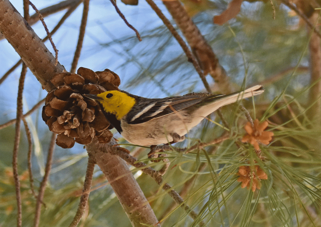
On the first day we walked on the nature trail near the campground and recorded seventeen species of birds, including a Hooded Oriole, which was common for us in the southwest, but rare for Page, which is just on the Utah border.

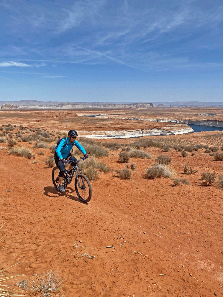
Later that morning, we mountain biked the Page Rim Trail, which is a sixteen kilometre loop around the city. The section of trail in the photo is pretty mellow; there are harder bits on narrow sections with drop-offs farther along. Notice how low the lake is; the white area along the water’s edge is the “bathtub ring” and shows how high the water used to be.

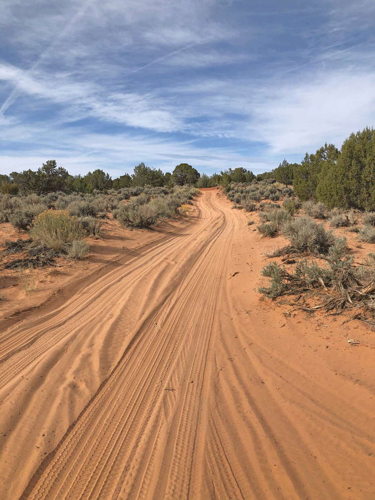
The next day we drove an hour along the highway in Utah, then turned down a “main” dirt road that eventually crossed the border back into Arizona. Soon we turned off and negotiated the sandy roads. Doug likens it to driving in deep snow – don’t stop!

Finally we were at White Pocket, which is a part of the Vermilion Cliffs National Monument. The sign warns, “Routes are not defined. Know where you are going and how to get back.” We had visited back in 2016, so we weren’t worried. It’s basically a large outcropping surrounded by desert scrub so there was a natural boundary.

We took so many photos. It seemed that around every corner there was another amazing view. Here’s a “long” view so you might get a sense of the scale.

Here’s the same formation a little closer.

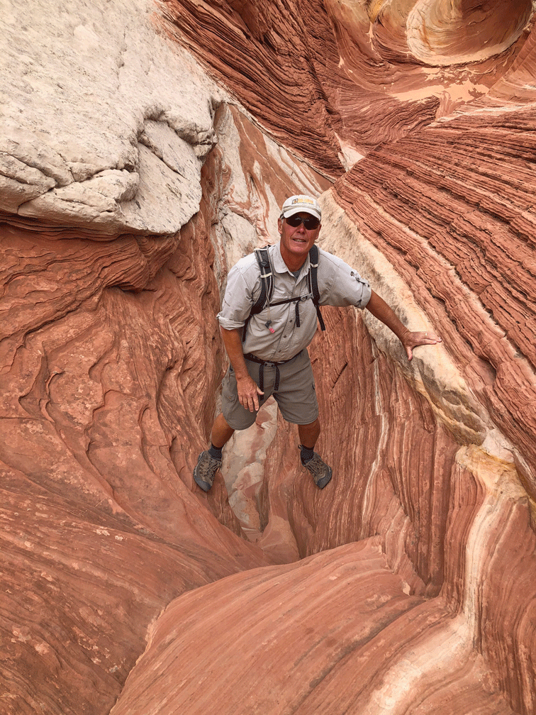
This is our favourite section. We climbed down this notch twice and up it once, because we kept circling around.

Here’s Doug in almost the same place.

Wendy just a little farther along, going back up to the notch.

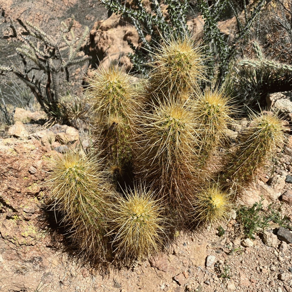
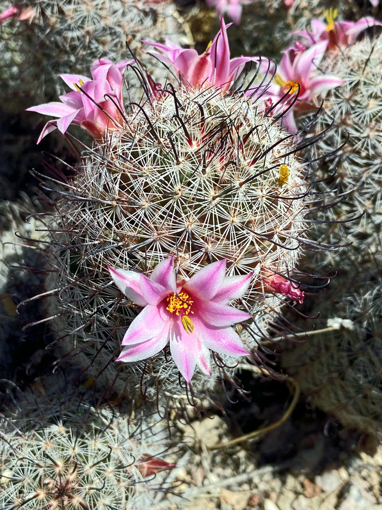
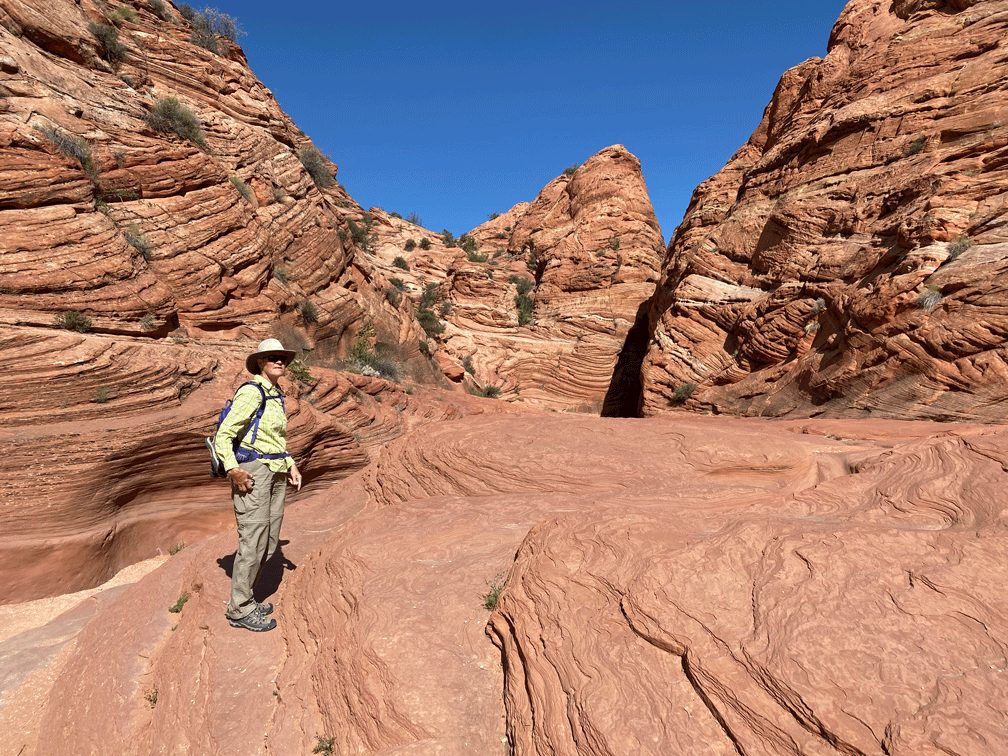
We liked the red rock best, but much of the area was white “brain-like” rock. Wendy is taking a photo of some cacti that are surviving in a rather inhospitable place.

This sloping ridged walkway is another favourite spot.

We saw other people at White Pocket, but it was easy to avoid them. We did stop to talk with a guide who had stationed himself while his clients clambered around him. He gave us the scoop to the route to Double Barrel Arch which was on our way home. The arches are visible from the main road, but he told us about walking up an old road behind them so we could get a closer view.

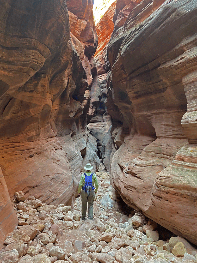
The next day we took the same “main” dirt road but stopped earlier at the Wire Pass trailhead. The trail followed a wash that led to a slot canyon.

It then opened up and there was a short section of red wavy rock.

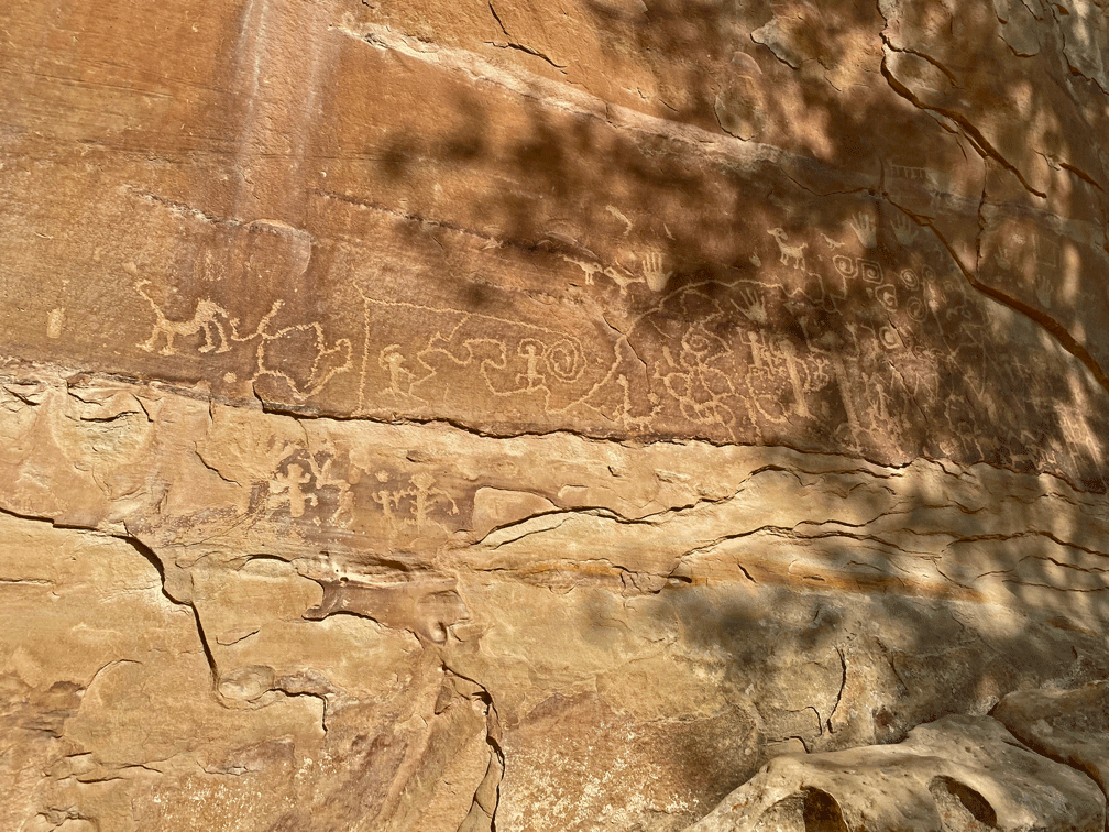
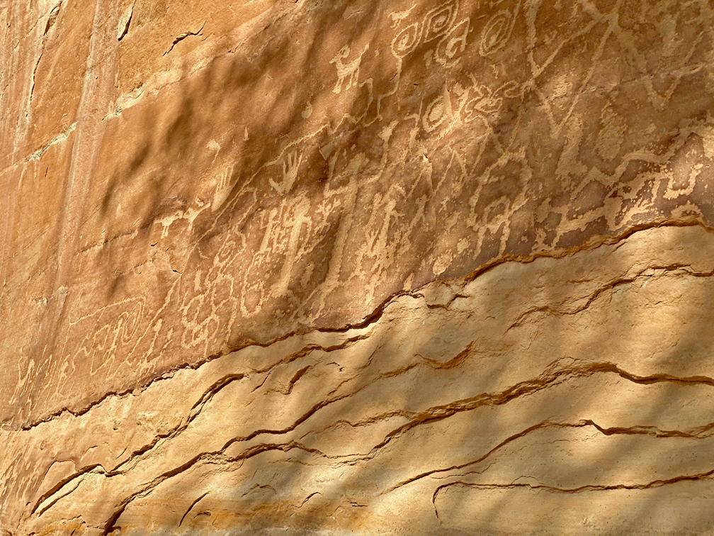
After the next narrow section, there is a wall of petroglyphs where the canyon from Wire Pass joins Buckskin Gulch. The bighorn sheep is Wendy’s favourite.

Now we were in Buckskin Gulch. We chose to turn right and head south (downstream if there was water). The other times that we had explored this direction were short-lived, because there was too much water. This time we brought water shoes but didn’t need them because it was completely dry.

This section would have been very difficult with muddy water covering the rocks.

The sun reflecting in an opening farther along makes the rocks seem like they are on fire.

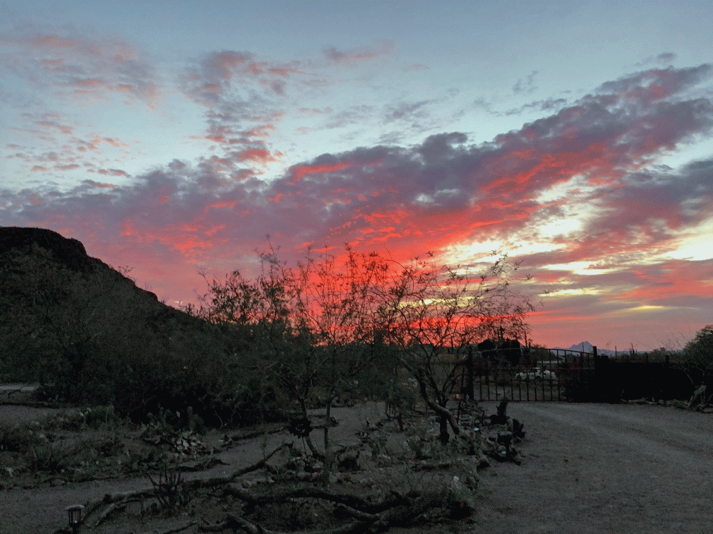
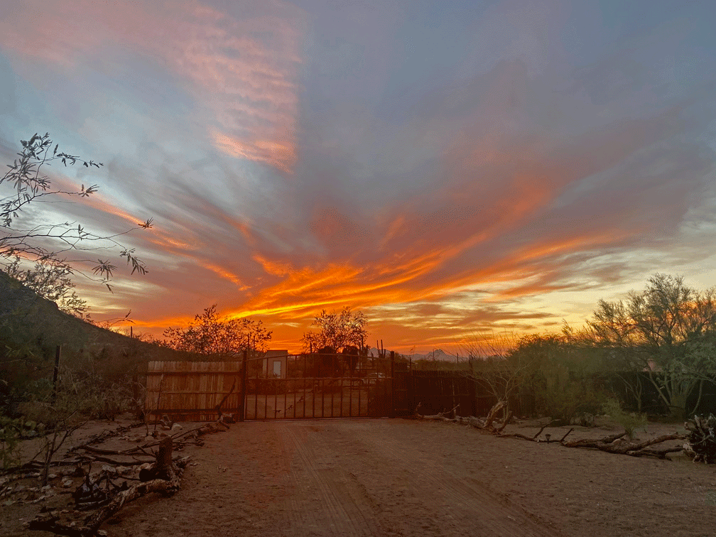
On our last night at Lake Powell we wandered around the campground at sunset. (As you may be aware, every post needs a sunset photo.)

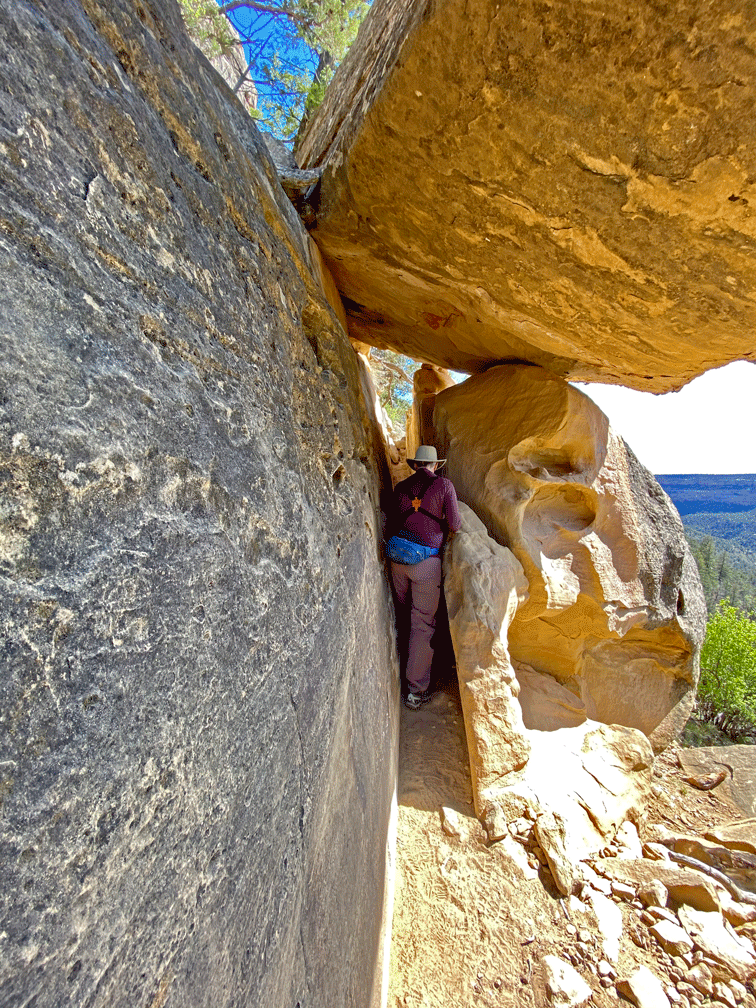
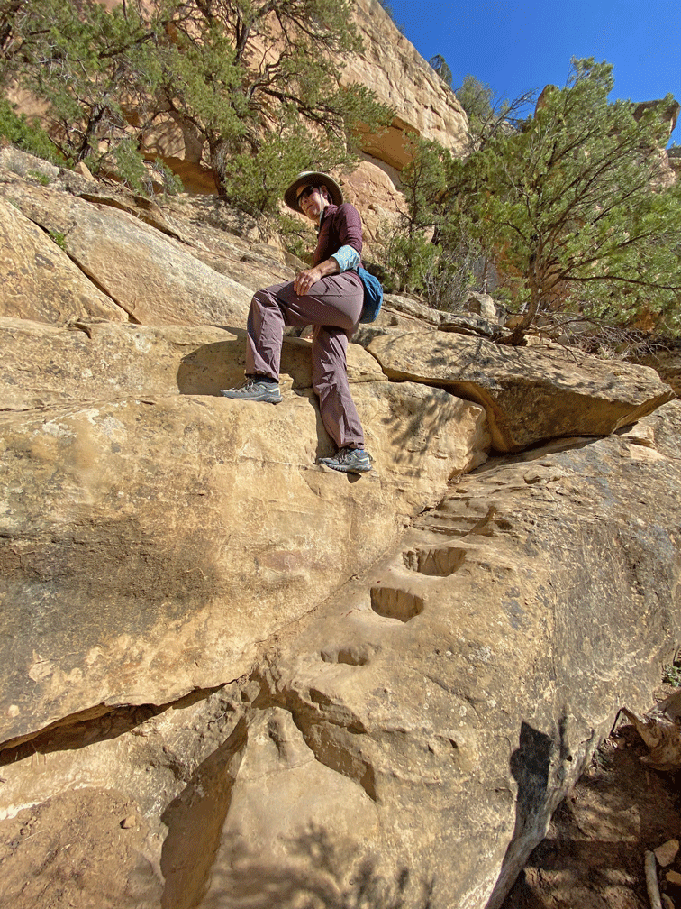
Next stop was Cortez, Colorado. We arrived around noon, just as a snow squall hit. However, it cleared up in a few hours, so we decided to drive up to Mesa Verde National Park. The road is 32 kilometres from the base up to the museum and the start of the hike to Petroglyph Point. That meant we didn’t start hiking until 3:45, which was unusual for us to start that late. The trail traversed the side of Spruce Canyon. There was one tight section.

We reached the petroglyphs in about an hour. The late afternoon sun made the panel stand out.

Here’s another view of the panel; the largest one in Mesa Verde.

Just above the panel, the trail heads up the cliff band. Steps have been cut into the rock.

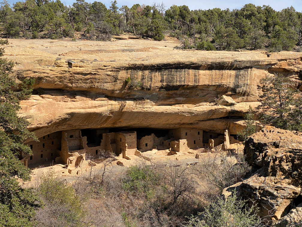
We followed the level trail along the mesa back to the museum. In the photo below, the trail is just out of view in the trees above Spruce House. On a previous trip, we were able to tour the ancient site. Currently it is closed to the public because park staff are stabilizing the access trail.

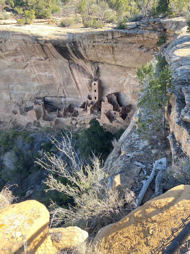
Another day, we did the road tour of Mesa Verde. We got to the Square Tower overlook around 9:30 and had the spot to ourselves.

Another big reason to visit Cortez is so we can ride one of our favourite mountain biking trails at Phil’s Trailhead. This section is called “The Ribcage” because it has a multitude of “down and ups” similar to a rollercoaster. Doug stopped to get this photo of Wendy near the bottom of the “whoops.” It was too much fun to stop higher up for a photo.

Then it was time to head home. The first day of driving over Soldier Pass in Utah and through Salt Lake City in the pouring rain, was less than ideal. So the next day we only drove as far as Idaho Falls. We got there early enough so we could get our COVID-19 test done in preparation for crossing the Canadian border.

Our results (negative) were ready by 7:00 the next morning, so we chose to tackle the long drive in one push. Our border crossing went smoothly and after an eleven hour trip, we were home in our own driveway. And now we are through our two week quarantine and ready to enjoy spring in the East Kootenay!

The Redwood is all cleaned out and “put to sleep.” Look for our next post sometime in the fall!

April in Arizona – Part 1

April in Arizona – Part 1

On April 1, we drove two and a half hours to Organ Pipe National Monument. Perhaps we were the “April Fools,” because by the time we started hiking (9:30) it was 26 degrees. We took the path to Bull Pasture that you can see veering off ahead of Wendy in the photo below.

Organ Pipe cactus has a limited range in the US. It is common in Mexico in eastern Sonora. It is far more frost sensitive than saguaros, so it grows better near rock outcroppings that keep the heat and shield it from frost.

The trail was through rocky terrain.

We climbed up to an area called “Bull Pasture,” which is an elevated plateau. We can’t imagine that any cattle would be happy here.

These Golden Hedgehog cacti were close to the trail, almost at the elevation of the “pasture.” They are another of the cacti species that is found here, but in only a few other places in Arizona.

This pretty cactus is quite small (15-20 cm tall) and according to our field guide, is “exceptionally common” in Southern Arizona. It’s known as Graham fishhook.

We came down from Bull Pasture through Estes Canyon. By the time we were back at the truck, it was 11:30 and 35 degrees. April’s heat wave had just begun.

The next day was too hot to bike or hike, so we went to Sweetwater Wetlands to look at birds. We were sitting in the shade, surveying the pond, when we saw this Green Heron catch a frog. It looked at first that it was too big for the bird to manage, but after the heron positioned the frog properly, it was able to swallow the whole thing at once. Notice the lump in the heron’s throat in the last photo.

We went to Reid Park for some birding, early on Easter Sunday. The park was busy with the “advance crews”: family members who were designated to set up and “claim” a spot for their family picnic later in the day. It wasn’t too busy for the birds, however.

This American Pipit had us stumped at first, because we would usually see it on mud flats and in a small flock.

We have seen Yellow-rumped Warblers almost all winter, but this male looked especially nice in his breeding plumage.

On our way home, we made a quick stop at Christopher Columbus Park, especially to see if the Western Grebe was still there (it was). We were really lucky to see this Hermit Warbler in a pine beside the lake. Hermit Warblers are only in southern Arizona during migration, and then they would be more likely to be found in a forest. This sighting was therefore given the “rare” designation. And it was the first Hermit Warbler we had ever seen.

Later that week, it was still too warm to do any more desert hiking, so we headed to the upper trails of Madera Canyon. We took the Old Baldy trail up to Josephine Saddle, where this photo was taken.

This photo of the tall pine (and Wendy for scale) is a few 100 metres down the “Super Trail” from the signpost in the last photo. We took the newer and less steep “Super Trail” down to our starting point to make a ten kilometre loop hike.

It was just after twelve when we got back to the truck, so there was plenty of time to look for birds lower in the canyon. This Arizona woodpecker was near the feeders at Santa Rita Lodge.

We walked the trail below the Madera Canyon Picnic site. This Painted Redstart put on a show for us for at least fifteen minutes, so Doug got plenty of photos.

Ramsey Canyon Nature Conservancy Preserve is just southwest of Sierra Vista and was on our list to visit. It used to be the Mile-Hi Ranch and still has some standing buildings, although many have been removed. Because it has high canyon walls and a perennial stream, it has a cooler environment. On April 12, we saw plenty of warblers: Lucy’s, Yellow-rumped, Grace’s, Black-throated Gray, Townsend’s, Hermit and Painted Redstart; and three species of hummingbirds (Rivoli’s, Black-chinned and Broad-billed.) There would be many more varieties of hummingbirds later in the season.

The Paton Center for Hummingbirds in Patagonia opened in April after having been closed to the public since spring of 2020. We visited the center on April 15, and were rewarded with a good view of the Violet-crowned Hummingbird, the species that made the center famous.

This Broad-billed Hummingbird, although more common, is our favourite hummingbird.

After the Paton Center, we headed to Patagonia Lake State Park. We walked the birding trail and saw Summer and Western Tanagers, and a Zone-tailed Hawk, along with forty-one other species of birds.

After that, we got a permit for the Sonita Preserve, which is just outside the state park. After driving to the end of the road and the parking lot, we walked down a service road to get a view of the lake. Through the scope, we could see Ring-billed Gulls in the middle of the lake and a pair of grebes (Western and Clark’s) in the bay.

We got five mountain bike rides in before we left the Tucson area. We sometimes set the alarm for 5:00 so we could be on the trail by 7:30 to beat the heat. Even though we rode the same trail in the Tortolita Preserve over and over again, it was never boring. We enjoyed mastering the tricky bits and noticing different things along the trail.

These two saguaros, dubbed “The Hugging Twins” were a significant landmark for us, because when we passed them we knew we only had five minutes before we could see the parking lot and the end of the trail. Each ride took us about an hour and a quarter.

We visited the Desert Museum for two more times in April. These Passionflowers fascinated us with their variety of colours.

These Long-spine Prickly Pear flowers were also captivating.

This Saguaro is from South America, and grows in Argentina, Peru, Bolivia and Ecuador. It has a showier flower than the local saguaros.

But the local saguaros were also putting of a show. This saguaro was an “early bloomer” on April 7 at the Desert Museum.

By April 15, the saguaros were blooming everywhere. This nice one was growing right beside the main road into our neighbourhood.

And the Palo verde tree in our yard was also in blossom.

We always want to include a sunset in our post. A few clouds always add some interest.

And this is the last one for this season from our spot in Picture Rocks, Arizona.

Part 2 will detail our trip home to Canada. You can look forward to sights from Page, Arizona (Grand Staircase Escalante National Monument) and Cortez, Colorado (Mesa Verde National Park).