Durango, Colorado

Durango, Colorado

Most tourists who come to Durango take a ride on the Durango and Silverton Narrow Gauge Railroad, but we watched it from our RV park instead. The train whistle blew in the morning and again in the evening as it passed Alpen Rose RV, just ten minutes north of town. We came for the mountain biking, fall colours, and craft breweries and we were not disappointed.

We rode trails in Horse Gulch that are accessed from town. If you looked in one direction, you might think you were in wilderness, yet just around the corner the trail overlooks the highway.

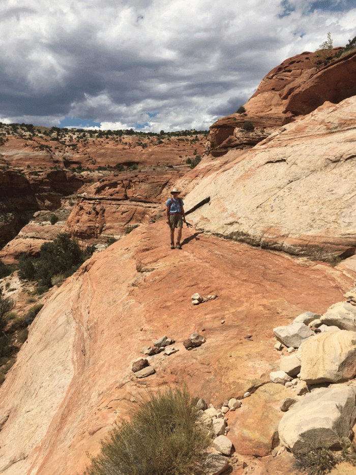
We’d heard about a great bike ride in Aztec, New Mexico (45 minutes south of Durango) called Alien Run. It was a great trail in its own right, but was made more interesting by being located right by a suspected UFO landing site. The developers have used the alien theme throughout their signage. There’s even a plaque at the site explaining the 1948 event.

The trail had lots of nice “flowy” bits on dirt, some interesting slickrock and a “hike-a-bike” section.


While we were in Aztec, we went to the Aztec Ruins National Monument. The ruins were misnamed when they were first discovered by the Anglo settlers. They were not built by the Aztecs, but by ancestral Pueblo people, from the late 1000s to the late 1200s. It was amazing to us to see the size of the great kiva and the number of other kivas and rooms. Here is a view of a portion of the ruin and one of Doug standing below a doorway that was built on a corner, something we had never seen in other ruins.

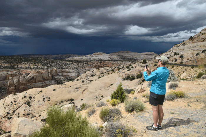
Between our mountain biking days, we took a road tour north on Highway 550, “the million dollar highway.” The passes on the highway north to Silverton are over 10,000 feet, and the aspen were just beginning to turn yellow. (We took the featured image on the website version of this blog at Molas Pass, about half an hour north of Durango.)

Fall_colours

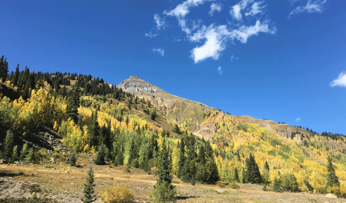
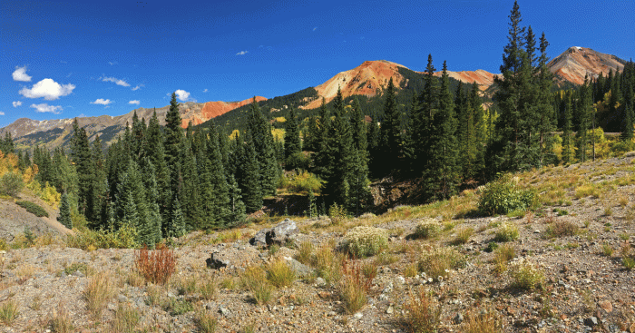
Although there isn’t a lot of fall colour in the photo below, we loved the contrast that Red Mountain gives to the scene.

Red_Mtn

Silverton was founded in 1874 and has kept its historic feel. It reminded us a bit of Dawson City, Yukon with its paved main street and gravel side streets.

After an amazing pizza and excellent beers at the Golden Block Brewery in Silverton, we continued north to Ouray, which is known as the “Switzerland of America.” Most of the buildings were built between 1880 and 1900. We tasted some brews on the upper deck of Ouray Brewery and took in the view. The photo on the right is of Ouray from the overlook above town.

And of course, we visited craft breweries in Durango. Our favourite was Animas. We had a very tasty appetizer there that they call ABC nachos, which was described as “crispy river chips topped with fresh corned beef, beer kraut, scallions and topped with cheddar sauce.”

At the end of the week, Wendy took her sewing machine and projects to Durango Quilt Company’s “Open Sew Friday.” She couldn’t believe it when an “almost local” fabric and pattern designer and former owner of the quilt shop in Delores, Virginia Robertson walked in. Virginia had a new pattern that she wanted to field test before final publication and offered it to any takers. So of course, Wendy put away what she was working on and jumped right in. She learned a new way of doing hand applique and had good conversations with fellow quilters.

Doug had no problem finding things to do on his own, which included another bike ride in the Sale Barn Canyon and Big Canyon area. We had a day for shopping, lunch and a brewpub stop, before we left for Taos, New Mexico. New adventures next post!

Bryce Canyon National Park

Bryce Canyon National Park

This was our second visit to Bryce Canyon, but the first time that we had camped up by the park. We had made reservations at “Ruby’s”, a 250 site RV park just at the park boundary. It was a huge park and there was a lot of space and plenty of grass for Tali. She enjoyed long walks while we looked at the birds. Highlights were Lesser goldfinches, Western bluebirds, Gray-headed dark-eyed juncos and our new favourite bird: the pygmy nuthatch.

We started early for our big hike at Bryce Canyon and were walking with jackets, hats and gloves by 8:00. We started at Sunset Point, down to the shady and chilly Wall Street. Once we got into the sun, we warmed up enough to take our jackets off. This was one of the views looking up towards the rim.

Bryce-Hike

We walked on the flats for a while, listening to the chickadees and Stellar’s jays, over to the Peek-a-boo loop.

Wendy_bino

We chose to do the Peek-a-boo loop counter-clockwise, because the people around us went the other way. Here is a view back to Sunset Point as we climbed up, with the trail all to ourselves for the moment.

Wendy_Bryce

Another view from the Peek-a-boo Loop.

PeakaBoo

And another, this time with Doug in it. This photo was taken at 10:30, while the sky was still clear, and the trail was relatively uncrowded.

Doug_Bryce

We continued along the Peek-a-boo loop, back to the flats, then followed the trail to the Queen’s Garden. The clouds moved in, and the trail became busy, so the photos weren’t as nice. Here’s an view of an interesting landscape that is past Queen’s Garden and up the trail almost to Sunrise Point.

Queens-Garden-trail

Once we were at Sunrise Point, we walked along the paved rim trail to our truck at Sunset Point. The “figure-eight” hike took us about five hours.

The next day’s event was mountain biking at Red Canyon, about a half-hour west of Bryce Canyon. Doug had fond memories of riding the Thunder Mountain trail, but Wendy wanted to save it for another day, so we parked at the Red Canyon trailhead, just beyond the tunnels. We were heading for the Cassidy trail, quoted in some mountain biker’s post as “the best trail you’ve never heard of.” We figure about three-quarters of it is fine; the rest is so rocky that it was “hike-a-bike” terrain for us. The trail is really a horse trail that mountain bikers now ride. We rode up Cassidy to Braxton Point, that had a great view.

We came down from the point and chose the Rich trail, then over to Ledge Point for lunch. The photo below on the left approaching Ledge Point and the right photo is one of the nicer sections of the Rich trail.

The next day, we made an early start for Durango, Colorado, a seven-hour drive. Stay tuned for our next post.

Escalante, Utah

Escalante, Utah

Doug was lucky enough to get a reservation for three nights at Escalante Petrified Forest State Park, for the days before our Bryce Canyon reservations. Escalante State Park is a small park about an hour east of Bryce and is a jumping-off point for exploring Grand Staircase – Escalante National Monument. There are only seven sites that have water and electricity hook-ups out of the 26 total sites. We believe we lucked into the best site: “Lakeview A” and you can judge for yourself by the photos below.

We wanted to do a hike that had a bit of adventure involved. We have enjoyed walking on slickrock and finding our way without a trail, so we chose to do Phipps Arch from a small, unmarked pullout off of Highway 12. If any of our readers have the “Wow guides Utah Canyon Country” guidebook, we followed their description – well, let’s say we followed our noses and used the description to try to confirm where we were. (Asking ourselves, was that the third or the fourth dry fall?)

We started down the slickrock, right from the truck, following a secondary wash, which is basically a dry river bed. Sometimes we found water in rock hollows, which were easy to walk around.

Wendy_slickrock

This is Doug standing on top of a dry fall or pour over. If there had been water, the waterfall would be about 150 feet (about a rope length). Here is the spot where we wondered if this was the third or the fourth dry fall. We went left up the bank until it became clear that we should have gone right, so we retraced our steps and headed up to the white rock that you can see behind Doug in the photo. There was a sandy slope farther along that allowed us access back to the wash.

Doug_pourover

Soon we were down to the Phipps Wash proper, with high red cliffs beside us, and welcomed shade. We continued along through the sand.

The route continued along the wash, through sections of vegetation: tall cottonwoods and thick tamarisk, until it reached “a substantial draw” that was the start of the cairned trail up through ledges to the arch. There was a bit of scrambling involved, with decent hand holds and good friction for the foot holds. We didn’t realize when we were rock-climbing in our 30s, that it would make it possible to scramble up canyons in our 60s! The arch is impressive, especially because you can’t see it until you are almost right under it. The feature photo (on the top of this blog post) was our first view of the arch. We climbed up, under and through the arch. The photo on the right below is looking back at the arch.

It took us about three hours to get to the arch, so after a quick lunch break, we headed down. The skies were darkening with clouds and we hoped to miss the storm. Below is a photo of Wendy on one of the ledges below the arch.

Wendy_ledge

We actually did get rained on, but we were past the steepest sections and by the time we got our rain gear out, it had stopped. It was cooler on our return journey.

The weather the next day was unsettled, so we chose to drive to Boulder over the narrowest section of Highway 12, with drop-offs on both sides. The road had been recently repaved and actually widened in sections. Boulder has the Anasazi State Park, which is a museum built right beside an actual ruin, some that has been excavated and on view, and some that is still covered. Even though we had visited it twice before, we learned something new. The most important reason to go to Boulder, however, was to go to lunch at “Hell’s Backbone Grill”, a highly rated restaurant that serves only local food. The photos below show the unique décor, (notice the garlic hanging from the rafters) and the requisite photo with our meal.

On our return to Escalante, the storm clouds and lightening were in the distance. We stopped at a pullout near the narrowest part of Highway 12 to take photos.

Wendy_storm

By the time we were back at our campsite, the heavens had opened. Tali was really happy to have company through the waves of thunderstorms that continued all afternoon and throughout the night. We were happy to have our cosy trailer and were glad we weren’t in a tent like many others in the campsite. (Or hiking in a canyon!)

The next day, we headed to Bryce Canyon National Park which will be the topic of the next post.

Going South in September

Going South in September

This September trip was meant to start with the Sisters Folk Festival, but wildfires and the resulting poor air quality forced the festival to cancel. We didn’t know this for sure until we were in Central Oregon and five hours into our second day of driving. So we regrouped. While Wendy stocked the trailer with groceries, (we’d already missed our planned Costco stop) Doug searched for the closest place out of the smoke and made a reservation at an RV park in Lakeview, Oregon; another four hour drive. The smoke cleared after a thunderstorm when we were just about at Lakeview, so although we travelled on roads that were new to us, we didn’t see much of the landscape.

We stayed two nights at the Junipers RV Resort, about 10 miles west of Lakeview, and it was perfect for us. We breathed clear air under sunny skies, hiked trails from the RV park, visited museums in Lakeview and did some bird-watching on the nearby reservoir. Here’s a photo of Wendy and Tali under blue skies at the Junipers RV park and a photo of an old quilt in the Schminck Museum in Lakeview. The Schmincks ordered their house from a Sears-Robuck catalogue and throughout their lives, collected a wide array of items, from household to firearms, and set up a free museum in their basement. Their whole house is now a museum, funded by private donations.

The time in Lakeview also allowed us to plan where to go next, since our idea to visit Crater Lake was also a “no-go” due to smoke. So we made an itinerary that used the time before our Bryce Canyon reservation on September 15. Which is how we ended up in Wells, Nevada for two nights. Wells is a community of 1500 where dilapidated motels decay in the once thriving downtown, and all the new hotel construction is out by the interstate.

Wells was a good place to stage from to visit Ruby Lakes National Wildlife Refuge, an hour and a half drive south on the main highway and secondary and gravel roads. Once covered by a 200-foot deep ancient lake, the “Ruby Marshes” now provide habitat for hundreds of species of birds and mammals. There is an auto-driving route on the dikes that were not crowded, so we could stop almost anywhere that we chose. We got some close views of a Virginia Rail and a Sora.

We saw many White-faced ibises, both flying and standing still. The white-face on a White-faced ibis is only discernable on the dark bird during breeding season, but the bird has a red iris (which is inconveniently blocked by a reed in the photo below) to distinguish it from a glossy ibis. We had a good look at a lone gull-like bird, which even with a photo is difficult to identify, but we’re going with a Forster’s Tern.

Wendy set up the scope with her “PhoneSkope,” which allowed her to take photos of a Great blue heron preening and sipping water. (Heron Yoga)

We realized that there was a national park we had barely heard about that was close to our route to Utah, so we stopped at Baker, Nevada to visit Great Basin National Park. The “Whispering Elms” was a motel, RV park, tent campground and bar all in one. It had plenty of shade. We’ve developed an uneasy fondness for gravel over the years because it’s not dusty or muddy.

On our first afternoon, we left the 30 degree heat of the valley floor and drove up the winding Wheeler Peak Scenic Drive to about 10 000 feet. (It’s funny how we are metric with temperature, but not with elevation.) We enjoyed the cooler air on a trail up to a bristlecone pine grove. (1½ hours total). Some bristlecone pines are nearly five thousand years old – the oldest living things in the world. The trees grow very slowly and are highly resistant to decay. They don’t rot, so they may remain standing for thousands of years after they die.

Bristlecone_pano

The next day had a good forecast, and all the reservations for the cave tours were booked. (Check out recreation.gov if you are planning to come to the park to get your reservation in advance.) Which meant that the 13,000 foot Wheeler Peak called to us. The trailhead started at just over 10 000 feet and was basically railway grade for the first hour, through aspen forest and mountain meadows. The photo of Doug below shows the route, from just below the trees on the far right, to the back of the rocky bluff and basically along the skyline to the top.

Doug_meadow

Doug got a great shot of the Wheeler Peak highlighted with yellow-orange aspen in the foreground.

Wheeler_aspens

There had been a lot of work put into the trail through the rock and rubble and it was easy to navigate for both of us who have tired artificial joints. We even managed the altitude reasonably well, and while we weren’t sprinting at the top, we were still moving fine. (Perhaps there also was that thought that if we stopped for very long we’d stiffen up altogether!) Doug took a photo of Wendy with a bottle of beer that had been left in the mailbox at the summit. There was no way we were drinking alcohol at that elevation; we didn’t even want to eat until we got down lower. (Except for the always available Werther’s). The summit had some built-up rock walls that would offer shelter and looked big enough for someone to use as a camp. Perhaps the rules were different in the past; now it is a no-camping zone. You can make out the road up to the trailhead and a campsite, on the green mountain behind Doug in the photo below.

The hike down the mountain was easier than we had expected. Wendy even had time to look at some grey headed dark-eyed juncos (a new variety of juncos for her) and was surprised she was able to catch up to Doug (who didn’t stop, since Wendy was the only one with binoculars). The climb took us about six hours.

We left Nevada the next morning and headed to new adventures in Utah, based out of Escalante and Bryce Canyon National Park. We’ll try and post soon.