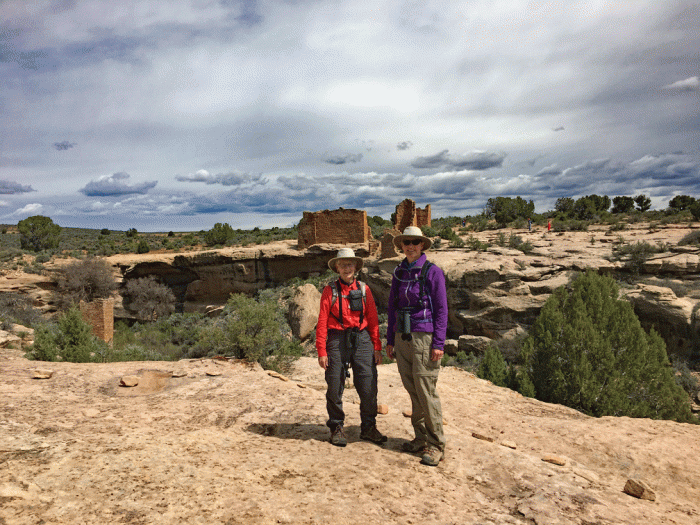
We did two hikes and a bike ride in the final week of our trip this spring. A cold front moved in as we were leaving Mesa Verde, so we chose to stay in Blanding rather than camp off-grid. Our first hike was at Natural Bridges National Monument, less than an hour drive from our RV park. The bridges were discovered in 1883 and proclaimed a National Monument in 1908, creating Utah’s first National Park system area. They are also part of the larger Cedar Mesa area. There is a paved scenic drive that allows easy access to the three bridges, and most people view the bridges from the overlooks or wander down the short trails to the base of each bridge. We wanted to travel the “unmaintained” trail from the first bridge (Sipapu) to the middle bridge (Kachina). We took the advice of the ranger and parked our truck at the Kachina Bridge Overlook and walked about an hour on the mesa trail to the trailhead for Sipapu bridge. The feature photo of this blog (on the website) is a slick rock portion of the mesa trail. Here’s a photo of the beginning of the descent into the canyon.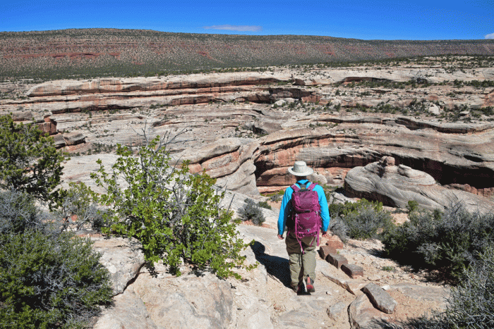
We worked our way down the trail, down steps, both metal and cut into the rock, and down wooden ladders to the base of Sipapu Bridge.


We had the trail to ourselves within five minutes along the canyon trail to the next bridge. The only other hiker we met was a ranger, until we got to the base of the Kachina Bridge. The photo on the left is the trail in the canyon. The photo on the right is taken below Kachina Bridge, a much thicker and younger bridge than Sipapu.


The trail up out of the canyon was well-graded and with not much effort, we were back at parking area at the mesa level. Our leisurely hike took us about four hours.
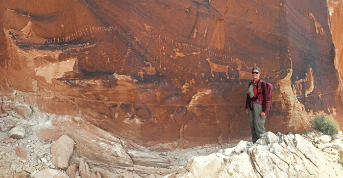
For our next adventure, we wanted to go back to a hike we did the first year that we came to Utah. It was our first foray up slickrock by ourselves, following written descriptions of the route. Back then, we got off route, following cairns that were leading us away from our destination. We poked around and found a way up that worked for us. When we set off this time, we wondered if we would find our old route or if the “standard” route would be more appealing. We had no trouble following our old route, and within 45 minutes we were at the “Procession Panel,” a petroglyph panel of 179 figures in a procession (we didn’t count them, but that’s what the guidebooks say.)
We ascended slightly higher, to the crest of Comb Ridge, for an amazing panoramic view.


We wanted to get one last mountain bike ride in before heading home, so we packed up and drove north and northwest, through Moab and Green River towards Price, turning south to Huntington State Park. The park was almost deserted because it was mid-week, but the park warden was telling us that the day-parking lot fills up by 10:00 on a nice weekend. It’s a great place to stay, with lots of trees and open lawns, as well as good birding opportunities.
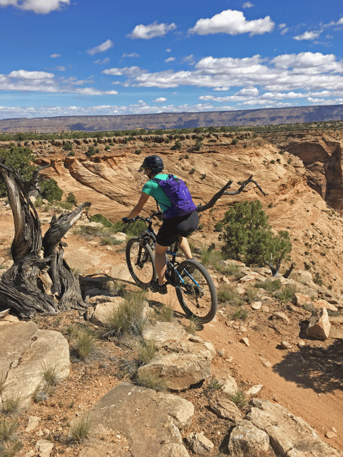
Our biking destination was less than an hour away, by highway to Castledale, then by good gravel road to “The Wedge.” It’s here that the San Rafael River has cut a huge canyon, known as “The Little Grand Canyon.” The Wedge Recreation Area features a mountain bike route that travels along the edge of the main canyon, along to a side canyon – the Goodwater, hence the name, “Goodwater Rim.” We rode about fifteen kilometres on the single-track winding trail, often just a few metres from the edge, before heading over to the main road for the ride back to the truck. We were on our bikes for about two hours.
Here’s a few photos of Doug on the Goodwater Rim Trail.


Here’s one of Wendy, closer to the edge than she thought was possible.
We took another couple of days to get all the way home. Now at home, the spectacular red rocks that we enjoyed so much throughout our seven week trip have been replaced with the gorgeous green of spring in the Rockies. “The Fox” is being cleaned and put away until the next trip. So long until then.