More hiking, some biking for Wendy and jeeping for Doug! The quintessential Moab experience. We were in Moab for another week and now that it is time to leave, we feel there is still much to do around here.
One day we hiked in Dead Horse Point State Park, which is across a canyon from Canyonlands: Island in the Sky. The state park has a paved road to the end of the point, with picnic sites and a viewing platform, but to see all the views from the rim, one needs to hike the rim trails. We met a few people hiking, but mostly had the trail to ourselves. The west rim trail looks down on the White Rim Road in Canyonlands National Park, a four-wheel drive road (or biking route for some) that we drove later in the week.


Hiking the rim trail at Dead Horse Point State Park.
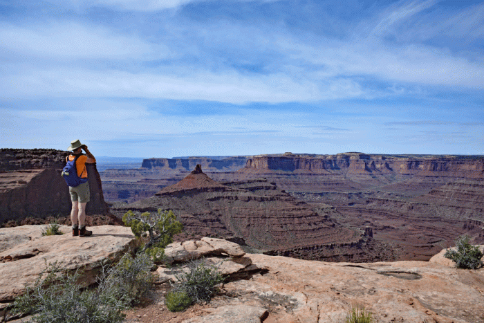
Looking over to Canyonlands National Park and the White Rim Road
The Fisher Towers trail was another recommended hike and one we didn’t get to the last time we were here. It’s out Highway 128, and like many of the spots around Moab, has a scenic the drive through a canyon to reach the trailhead. We started early enough to walk up in the shade. The trail was narrow in spots. The walls were so high beside us that we couldn’t look up too long because we were straining our necks. There was one steep bit with a metal ladder. The views were spectacular all the way to the top.


The trail to Fisher Towers
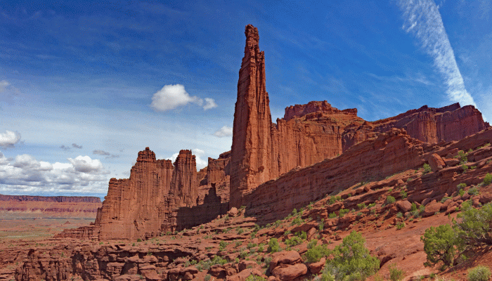
The view from the top of the Fisher Towers trail
Back in 2014, when Wendy was recovering from her hip replacement, we came to Moab. Her first slickrock experience was difficult for her; she lagged behind Doug and needed to walk long portions. Now that she knew she was in better shape, she wanted to go back and ride it again. This time, she was by herself and needed to follow cairns and faded white dashes painted on the rock. (So no action shots from the photographer). She found the route much easier; she rode past her old rest stops, stayed on her bike through more of the rough spots and completed it in half the time of the previous trip.
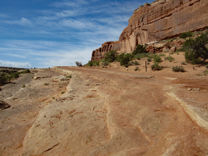
The slickrock on Wendy’s route around Courthouse Rock (Monitor and Merrimac Trail)
We also checked out the slick rock bike trails in the Sand Flats area just above Moab. We’re looking forward to riding here the next time we’re back (and Doug can ride).
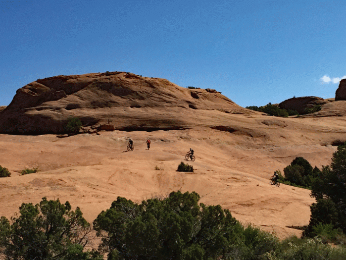
Some awesome female riders show us how its done at the Slickrock trail above Moab.
As it worked out, we had a free afternoon so we decided to hike to Delicate Arch. Delicate Arch may be considered the quintessential hike in Arches National Park; it’s on most of the Utah license plates and people seem to make a pilgrimage to it. It’s not an easy hike; there is a wide expanse of upward sloping slick rock, cairn marked ledges and in the afternoon there’s virtually no shade. It has an international draw as well; we heard at least five languages spoken on the trail. And then there’s the photo line-up to have your chance under the arch. We didn’t have the patience for that, but many did. Perhaps the hike was an epic for some or inspired others to continuing hiking. For us, it was an enjoyable half-day hike to a beautiful arch that we shared with a couple of hundred others.

Delicate Arch
On our last full day in Moab, we rented a jeep and took it up Long Canyon to the plateau at the level of Canyonlands National Park. We made it easily under the fallen boulder (the F-350 might have had trouble). The tricky bit at “Pucker Pass” (yes, that name is on the map) required us to move a few large rocks to make a route. Notice how the wheels of the jeep are articulating at different angles.


The fun bits of the drive up Long Canyon
We continued over to Canyonlands National Park, down the Shafer Switchbacks and to the White Rim Road. We followed the White Rim Road past Musselman Arch, Airport Towers Campsite and a fun rocky bit before turning around. We drove back via the Potash Road, passing “Thelma and Louise” point (from the closing scenes of the movie of the same name). We took the roof off the jeep as soon as it was warm enough so we had great views of the cliffs above us throughout the day.
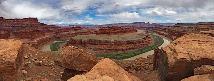
A view of a gooseneck of the Colorado River from the White Rim. Deadhorse Point State Park in upper left.
We’re on our way to Fruita, Colorado next for some mountain biking and hiking and another visit with Kath and Jeff. We don’t have wifi in our campground, so we may not post for awhile.

Very interesting country.
LikeLiked by 1 person