

This blog post will be about our trip to Northern Arizona and a couple of local hikes. We have included several bird photos, but the majority of the photos are scenic shots.
In the third week of March, the temperature in Tucson was expected to be 40 degrees C (104 F) for a few days. We decided to visit Northern Arizona where it would be cooler, so we booked three nights in a hotel in Flagstaff.
On our way north, we stopped at a piece of desert scrub that although barren-looking, was favoured by thrashers and other desert birds. Other birders had discovered this spot, and its eBird hotspot name includes “(thrasher spot)” in its title. We had visited the same spot in February without success, so we were hopeful that this time we could hear and see a LeConte’s Thrasher. LeConte’s thrashers like dry areas with a few bushes and lots of bare, sandy ground. They also like to sing perched up and luckily this one was far enough above the rest of the shrubbery that we could see it when we were over 200 metres away. It was also lucky that it sang for a long time and stayed in the same place, so we could walk over and skirt around it to get the light right.
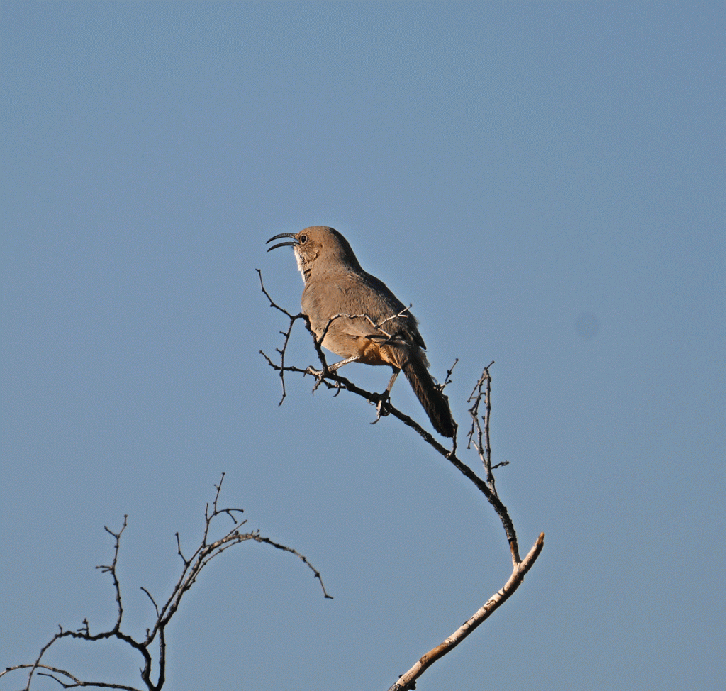
The thrasher is just barely visible in the photo below. It’s the highest speck above the bushes.
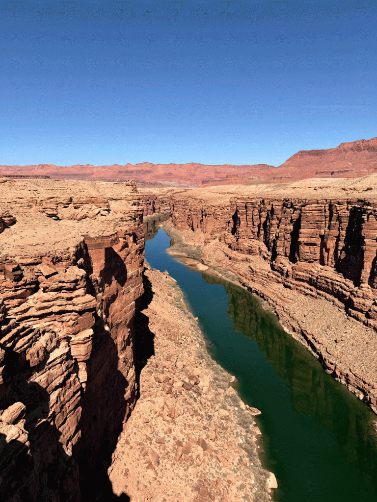
We had allocated a couple of hours to see the thrasher and we were out of there in 45 minutes, so we had time to drive to see another bird. We continued past Flagstaff, north on US 89 highway, to the historic Navajo Bridge at Marble Canyon. Here’s a view of the Colorado River taken from the Historic Navajo Bridge, a pedestrian only bridge. We got there about 1:30 which was little early for the California Condors to be roosting. There were other birds around; Common Mergansers and American Wigeons way down on the river and House Finches flitting about.
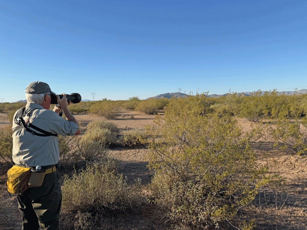
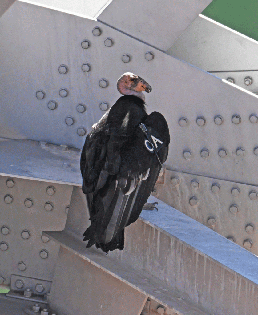
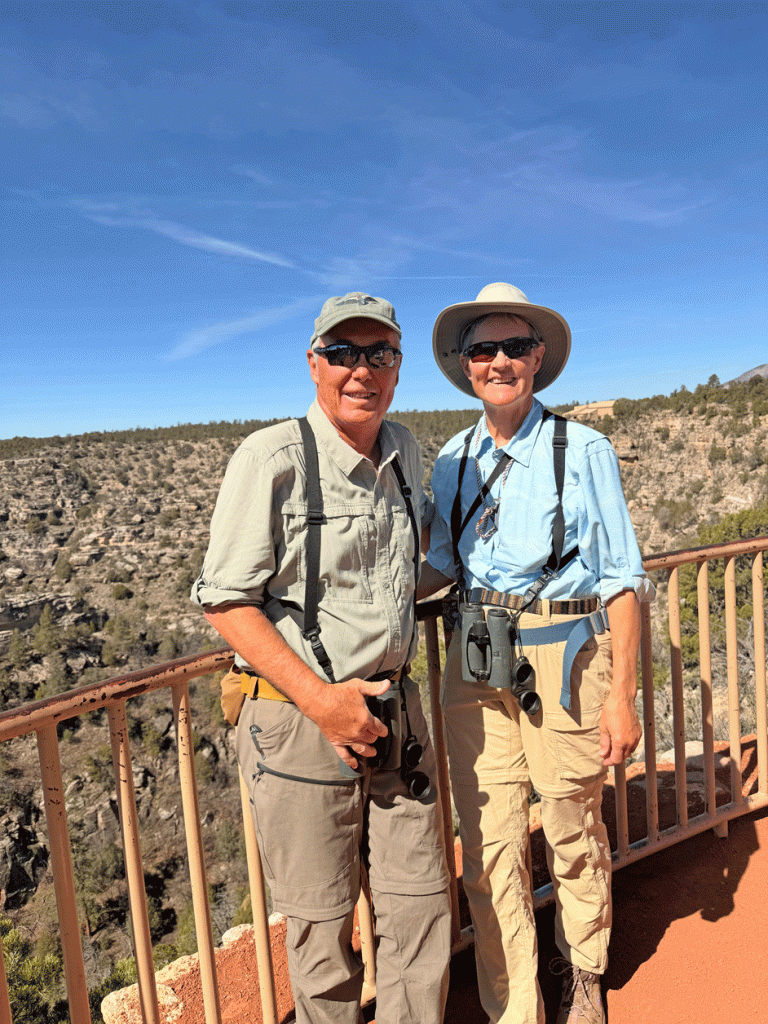
Around two o’clock, some other people saw the condors come in and alerted us. Our binoculars and camera gave us away as “birders.” We saw a couple of condors down in the rocks, and then another two perched on the main bridge. Below, Doug is taking a photo of one of the condors on the rocks.
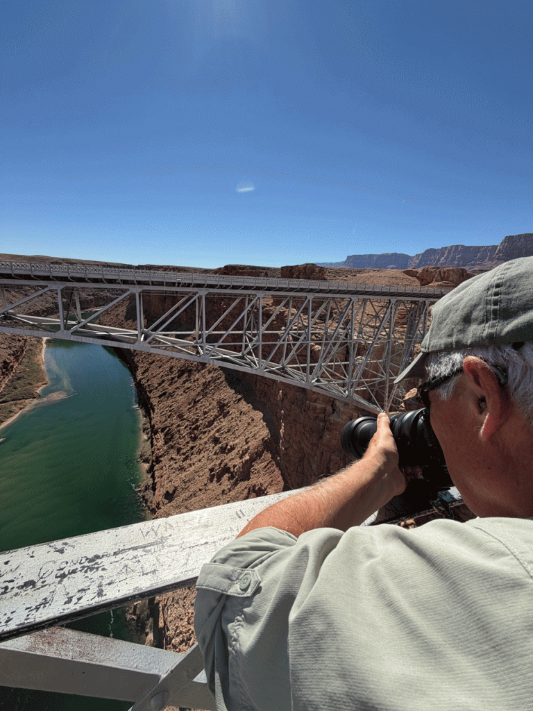
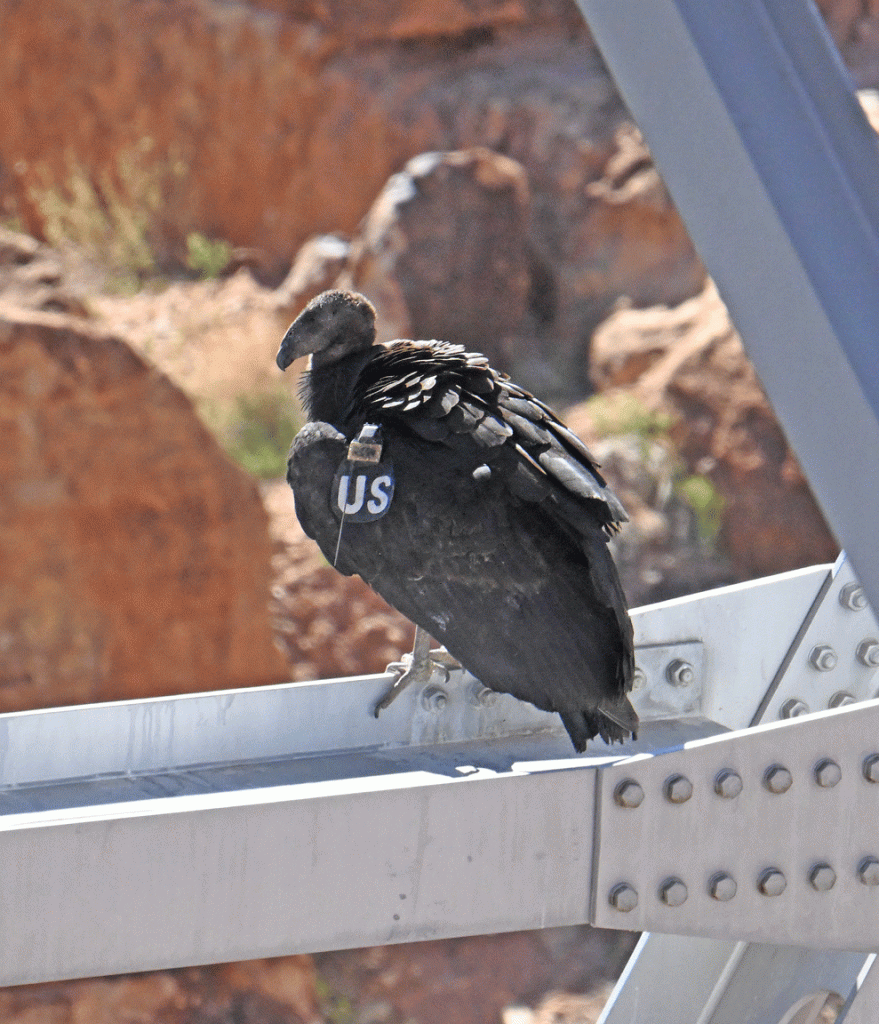
The California Condor is a critically endangered species that nest high on cliff faces. In the 1980s, the population fell to about 22 birds and now, with captive breeding intervention, there are over 275 free-flying birds. They have transceivers and labels so they can be tracked. We looked up the information about the bird with the OA tag on condorspotter.com and found out that OA is a female who is almost 5 years old. She was hatched at the World Center for Birds of Prey in Boise, Idaho. She was probably released at the Vermilion Cliffs Release site, which is nearby in terms of distances condors fly in a day. She was trying to sit in the shade of the girders on this hot day.
The condor with the US tag was hatched in the wild in the spring of 2024. Its neck will begin to turn pink in its third year, and will be adult-like in its fifth summer.
We drove back to Flagstaff for the night. It was a long day of driving with some rewarding minutes with special birds.
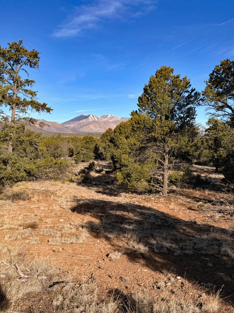
The next day, we wandered through some juniper / pinyon pine forest just east of Flagstaff at Cosnino Road. We were searching for a Juniper Titmouse and a Pinyon Jay that our friend had seen there a few days before.
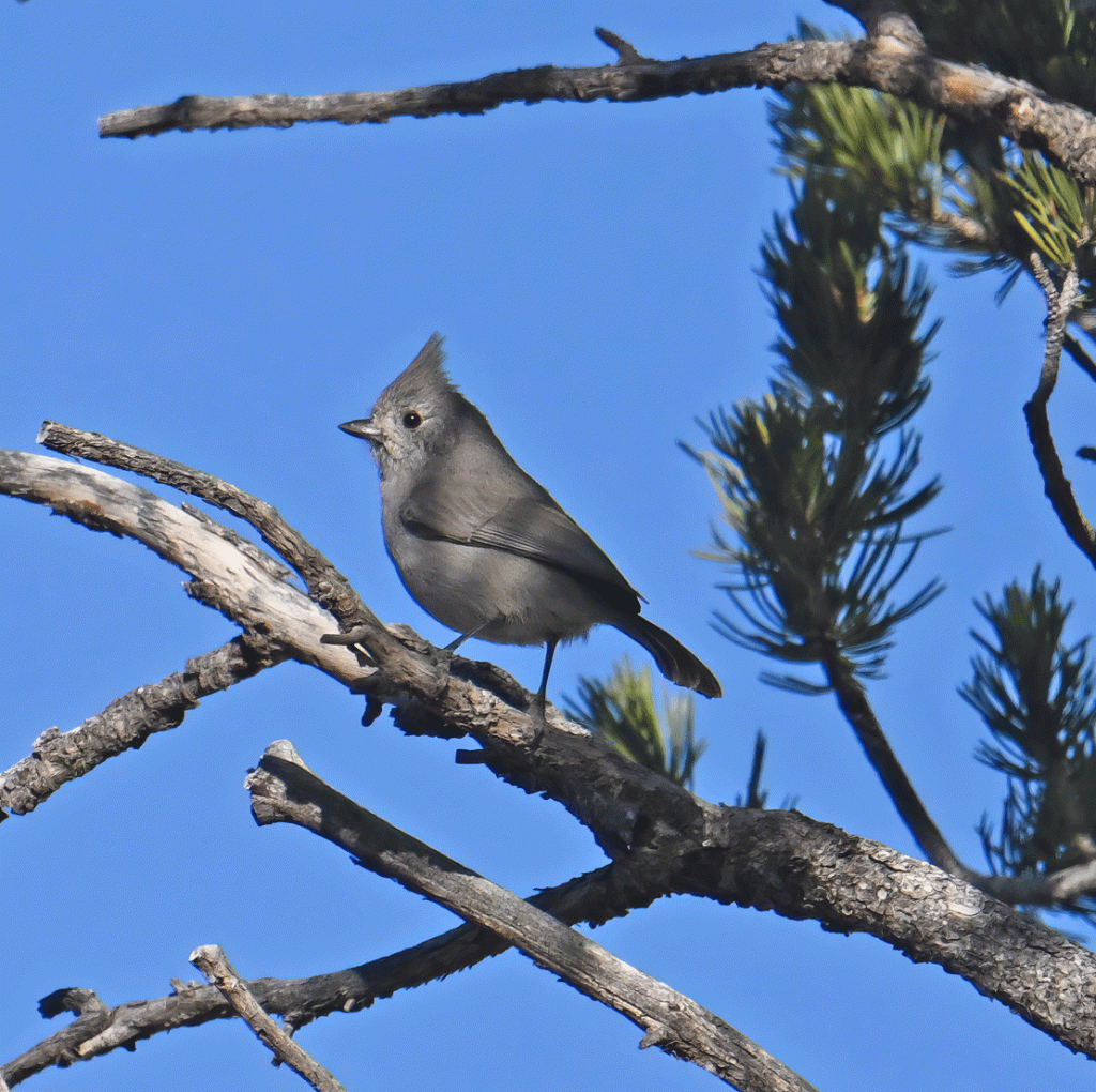
We heard the Juniper Titmouse right away, but it took us a little bit to get our eyes on one. Luckily one popped up in the sunshine. They are plain and drab but also cute like every other titmouse. They live year-round in Arizona at higher elevations. We didn’t hear or see a Pinyon Jay.
Next we went to Walnut Canyon National Monument and got there for their nine o’clock opening. The monument was established in 1915, to help preserve the cliff dwellings that are found throughout the canyon that were being damaged by pot hunters.
Only a small portion of the canyon is open to the public. We chose to walk on the 1.6 km (1 mi) Island Trail to begin. The Island Trail is accessed through the visitor centre, then drops down over 50 metres by staircases. The trail then makes a loop around the rock outcrops.
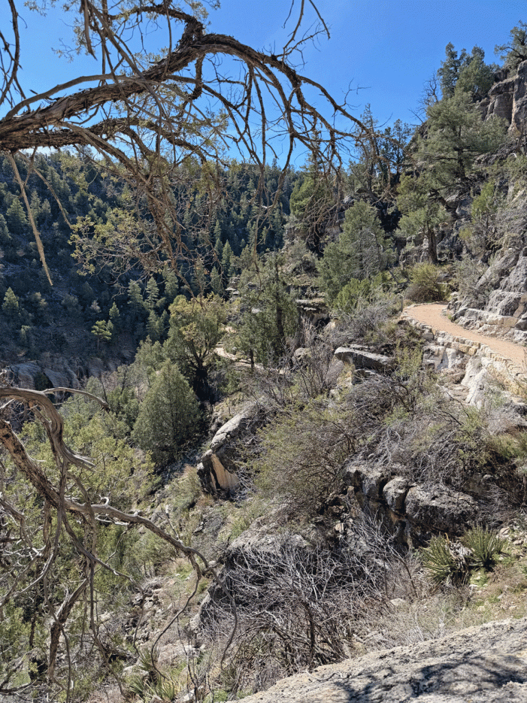
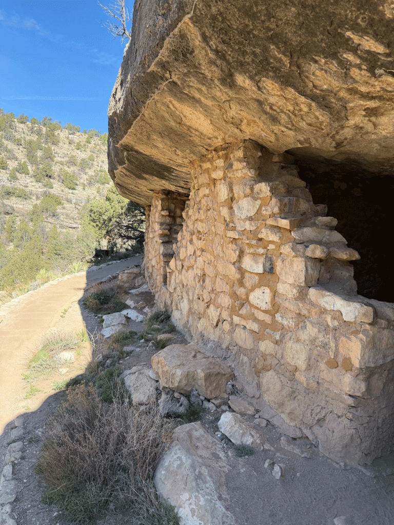
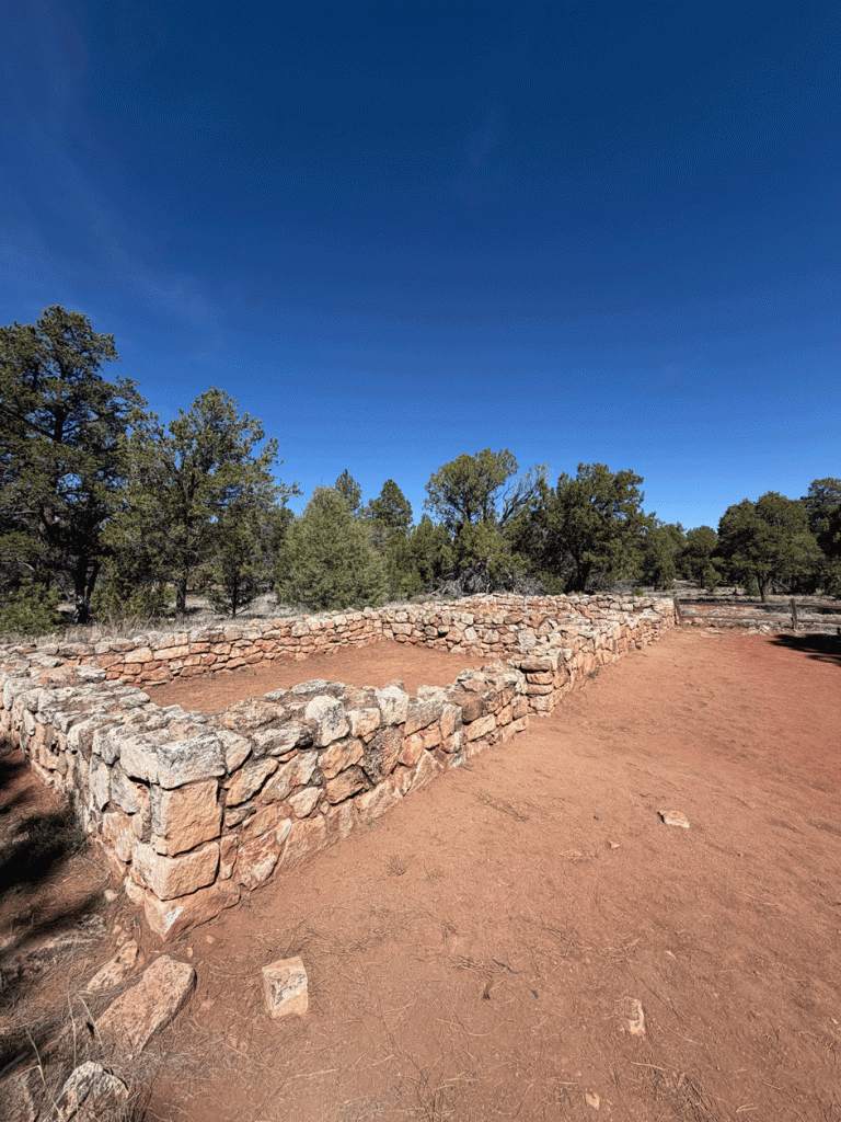
The trail goes right past some ancient dwellings, that were built on the limestone cliffs between 1125 and 1250.
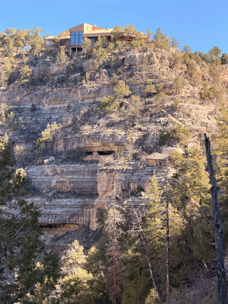
This is the view of the Visitor Centre and the cliff that we descended. Railings and stairways are visible on the trail.
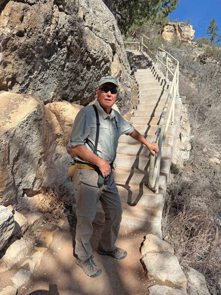
Once we descended the main stairways, we followed the one-way loop trail around an outcrop. There were more stairs along this route as well. The quote that we learned at the Grand Canyon, “Going down is optional, returning is mandatory,” was appropriate here. We did fine with the 273 steps that we came down and went up again, as well as the 190 stair steps along the loop. (A information sign provided the numbers.) The whole trail took us about an hour.
We walked along the rim trail as well and had an interesting conversation with couple from Wyoming at an overlook. We took their photos so they took one of us.
This is a partially reconstructed pueblo that was along the rim trail.
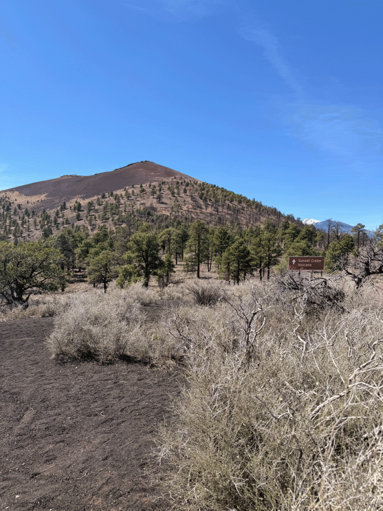
It was still early in the day, so were drove to Sunset Crater Volcano National Monument. Here’s a view of the crater from an overlook at the border of the monument. Sunset Crater erupted about 900 years ago and is the most recent volcanic eruption in Arizona.
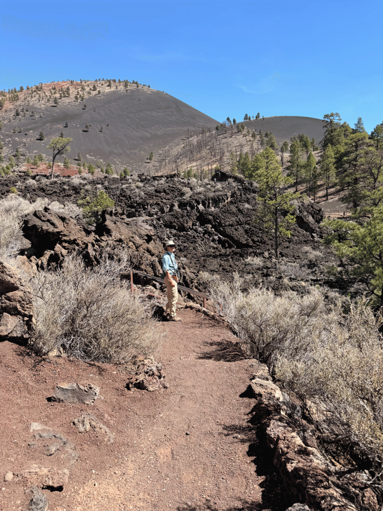
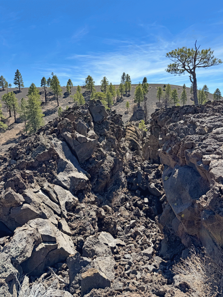
We walked on the Lava Flow Trail on the other side of the volcanic cone. Hiking on the crater was banned in 1973 because the trails were becoming trenches and eroding the cone. From this angle, you can still see the scars where the former trail was filled in.
This is a “squeeze-up” in the Bonita lava flow that was right beside the trail. It was formed when molten lava oozed out through a crack in the solid lava shell, much like toothpaste squeezed from a tube.
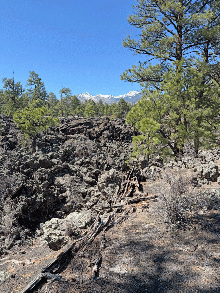
Here’s another view of the Bonita Lava Flow, with the San Francisco Peaks in the background. We kept our eyes out for the elusive Pinyon Jays, but only saw Stellar’s Jays.
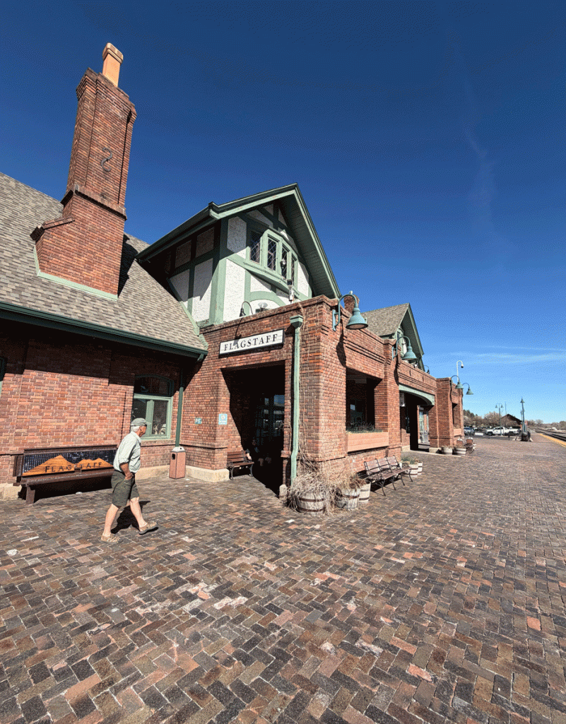
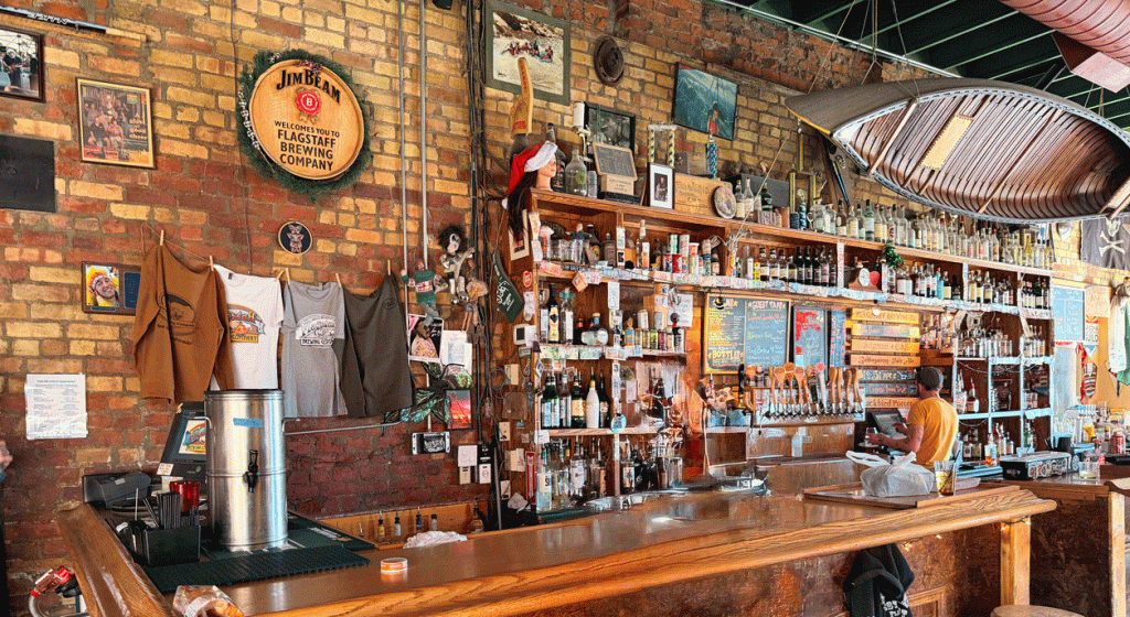
Because we were in “tourist mode” we visited the Flagstaff Visitor Center. It also serves as an Amtrak Railway station. The downtown area had several breweries within walking distance of each other, but our challenge was where to park. The visitor center staff member gave us a map and explained how to get to the parking lot.
Flagstaff Brewing is one of the oldest brewery in the area, opening in 1994.
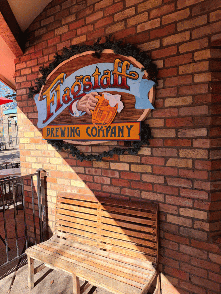
It’s a small brewery and they can’t offer all their beers at the same time. Wendy thought their Blackbird Porter was one of the best she’s tasted. Doug enjoyed the Bitterroot ESB. We might need to go back sometime to sample their Agassiz Amber ale. We enjoyed their eclectic decor.
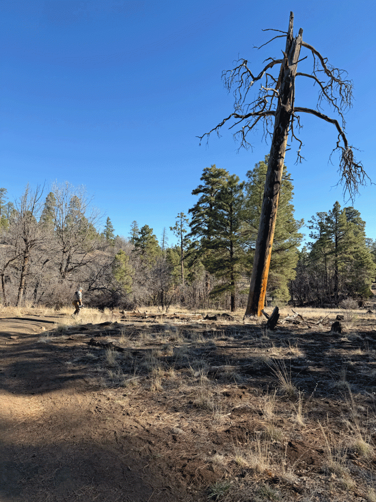
The next day, we visited Picture Canyon on the Rio de Flag, which had the right habitat for Pinyon Jays, although they weren’t there that day. We’ve heard birders describe the jays as being “ephemeral.” Yet even though we didn’t see those birds, we saw some other birds as well as some interesting country.
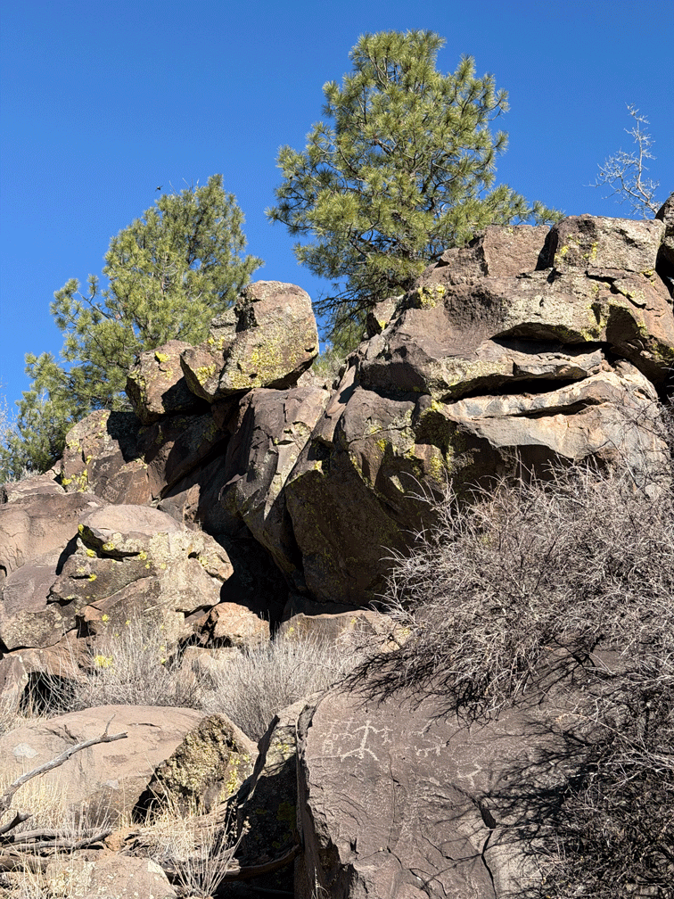
The area was called Picture Canyon because of the petroglyphs on a rock outcrop. Petroglyphs are rock carvings made by pecking or scratching the outer rock surface to expose a lighter rock underneath. They were formed by people who lived in the area nearly a thousand years ago. Here’s a view of the whole section.
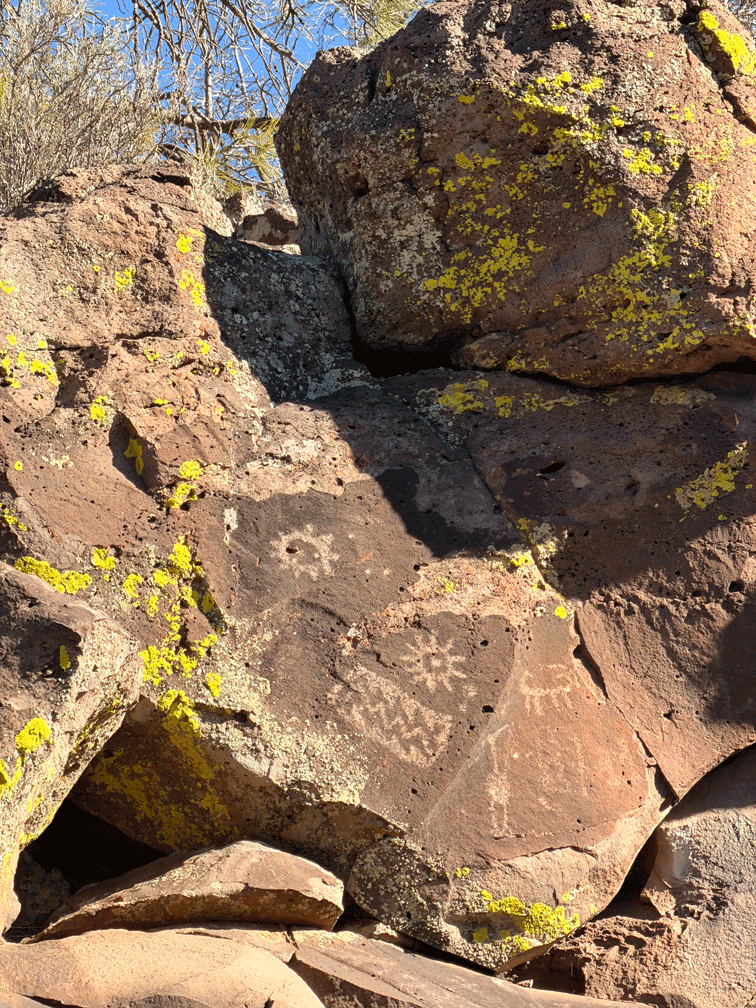
Here’s a close-up of the rock with the “water bird” petroglyph, that is quite high up in the boulders. It’s quite faint, but unlike any we have seen at other sites. It could represent a crane or a great blue heron. The zig-zag to the “bird’s” left could be lightning, water, or mountains. We have seen carvings similar to the animal (bighorn sheep?) at several other sites throughout Arizona and Utah.
On our final day, we drove to Marshall Lake, up on the Anderson Mesa, which is another possible spot to see Pinyon Jays. (Nope) Marshall Lake which is really more marsh than water, was full of coots and other waterfowl. There were a pair of Bald Eagles on a nest as well. We were lucky to be there when there was water in the lake because some years the lake dries up completely. There were several primitive camping sites in the area.
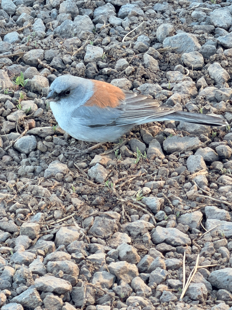
Here’s a Dark-eyed Junco of the Gray-headed subspecies. This one was foraging just a few metres from where we parked the truck and seemed unperturbed with our presence. When we first saw this sub-species several years ago, we thought we had seen a new bird, and we were a little disappointed to discover it wasn’t. The Dark-eyed Juncos (Gray-headed) behave much like the Oregon subspecies that we commonly have in BC.
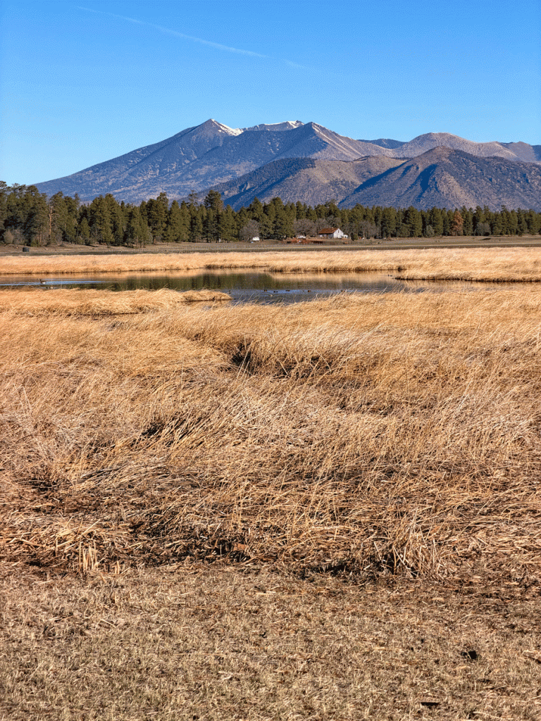
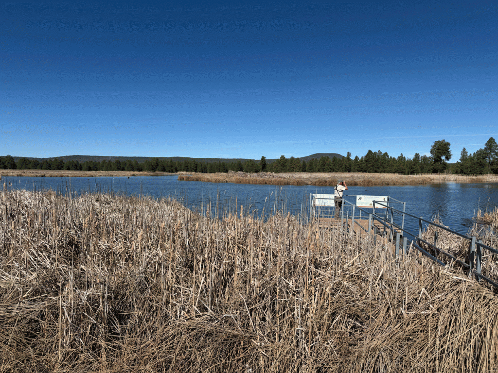
There was no point returning to the heat of Tucson early, so we checked out the Kachina Wetlands that are just south of Flagstaff. Like most hotspots with water in Arizona, reclaimed water is used to provide bird habitat. Pond #1 (below) always has water and one or two other ponds have water if there is excess. This pond had the most Virginia Rails that we have ever experienced in one location. There was a rail in each corner and another one in between along one side.
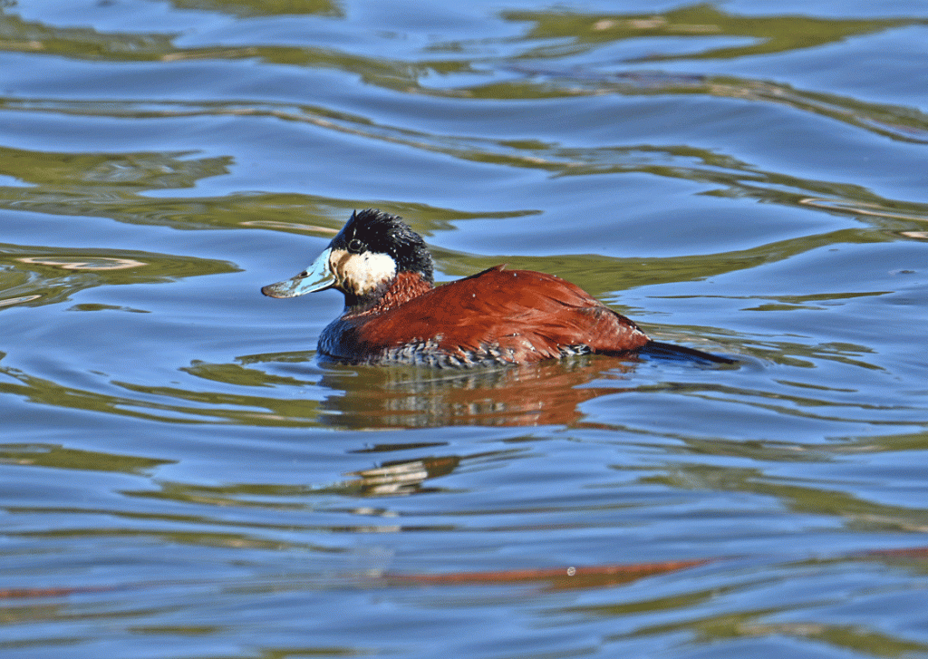
This Ruddy Duck has mud on it from its foraging efforts. We made it back to our trailer by about 3:00. It was 38 degrees C (100 F) outside and 30 (86 F) inside. Luckily we got the inside cooled off enough to be able to sleep.
Before the heat wave, we made our annual hike up Wasson Peak in Saguaro National Park (West). Here’s the view from near the top looking down on Tucson.
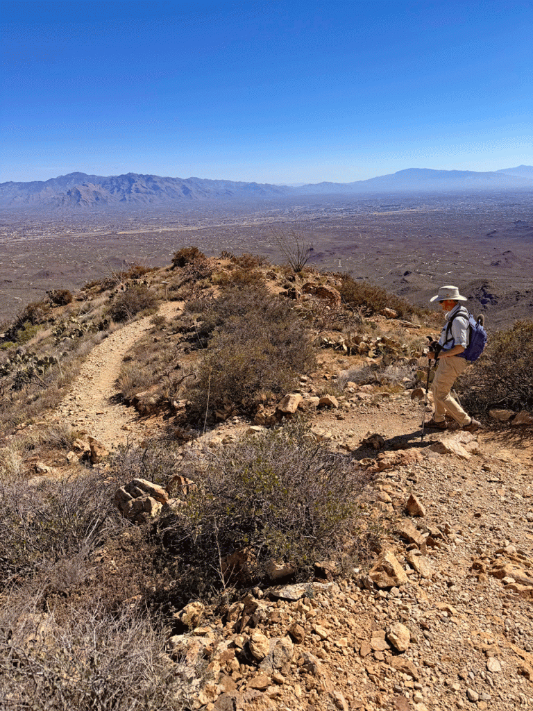
This section is part of the Hugh Norris trail, that follows the ridge. The granite in this area makes a nice sand for the trail surface.
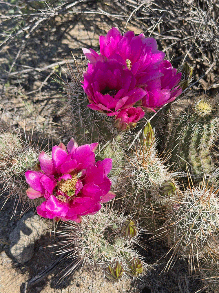
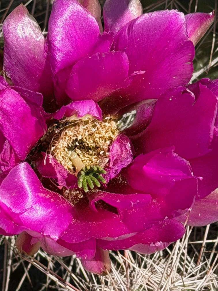
We went our regular route using Esperanza Sendero to connect to the Hugh Norris trail. We found early hedgehog cactus blooms along this former mine road.
We noticed that cacti that bloomed later, faded quickly because of the heat.
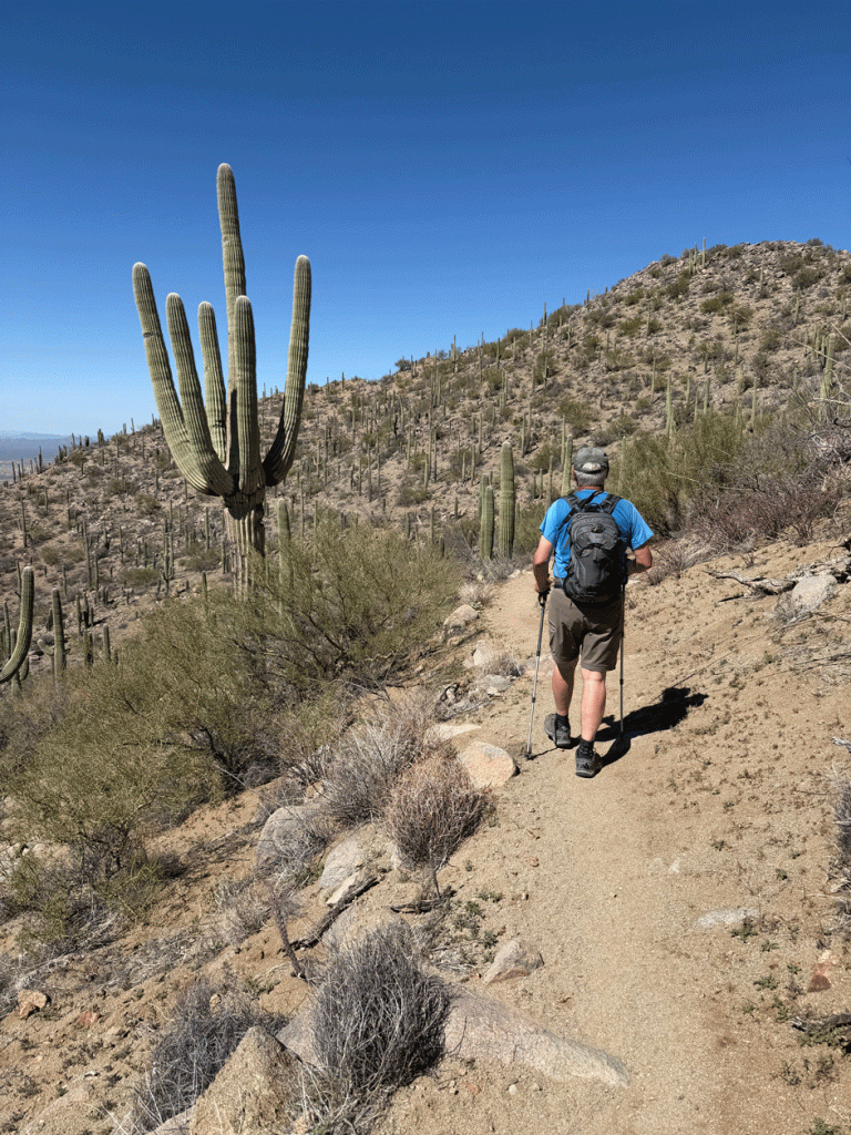
When we got back from Flagstaff, we expected that the heat wave would be over, and even though it wasn’t extremely hot, it was still hot. We got into a routine of waking up at 4:30 so we could be starting our activity at sunrise. This particular day, we wanted to go to the Desert Museum, but it didn’t open until 8:30. So at 6:30 am, we started our hike up King’s Canyon. The parking lot is just across the road from the Desert Museum. We’re always amazed at how the saguaros and other bushes can grow on the cliffside.
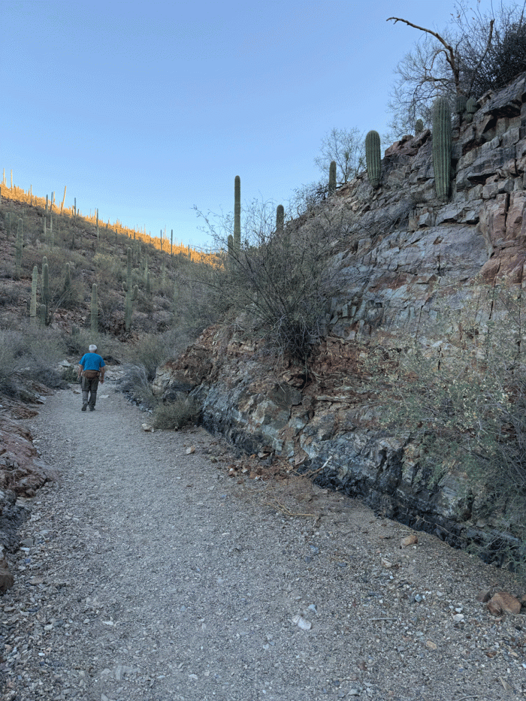
There are several rock steps going up the canyon; some we climb up directly and others we avoid by scrambling up a trail on the side.
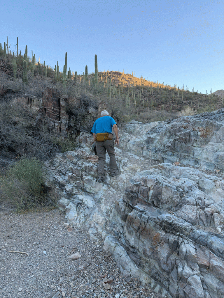
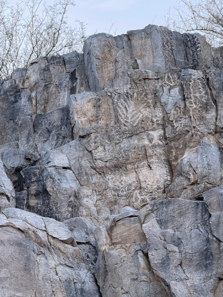
We got to the old dam area and the petroglyphs in half an hour. Every time we do this hike we take another photo of the ancient artwork. Perhaps we’ve shared this same view.
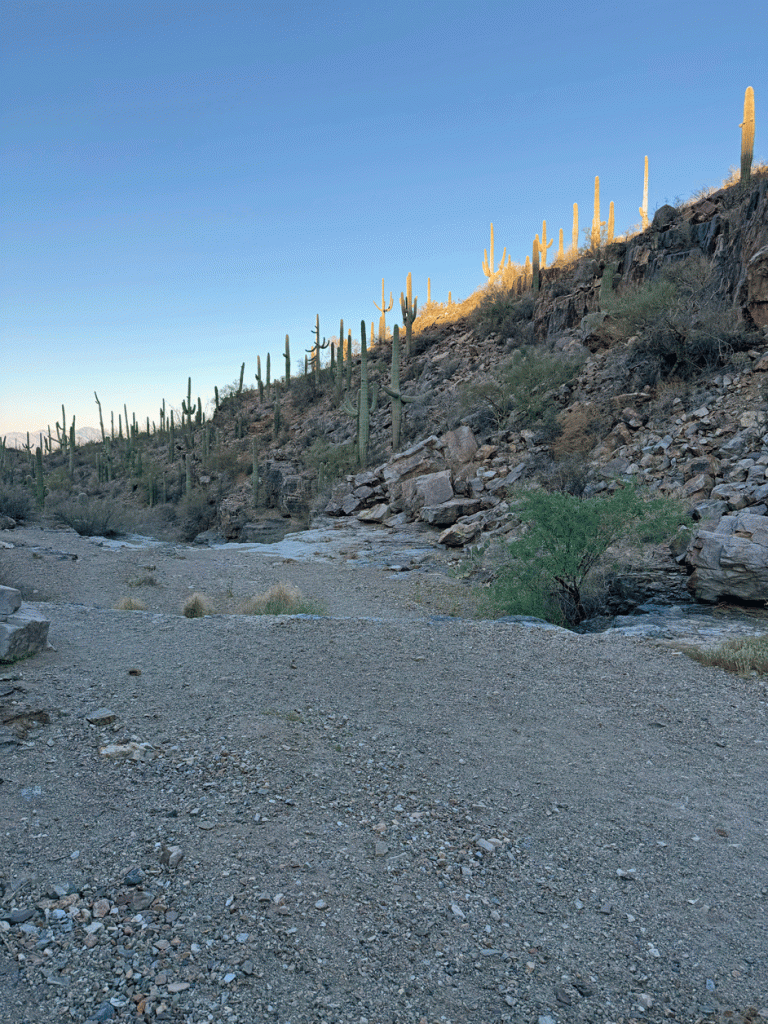
This photo was taken from just above the dam. Like other old dams in the area, the sediment has built up behind the dam to make a sandy flat surface.
We decided to walk up and through the picnic area and follow the Gould Mine Trail back to the trailhead. This Buckhorn Cholla bloom caught Doug’s eye.
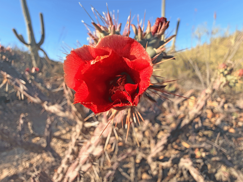
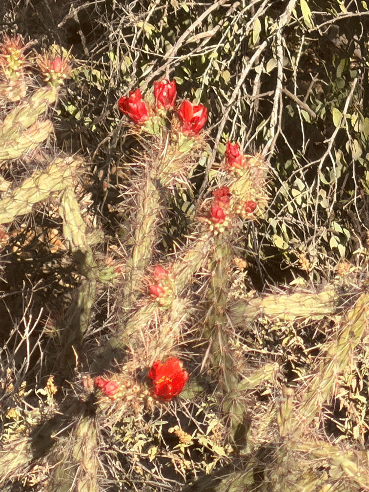
Here’s a photo of part a different Buckhorn Cholla to help with scale. Buckhorn Chollas have skinny arms with joints that are reminiscent of a deer’s antlers. The flower is only about five centimetres (2 inches) in size.
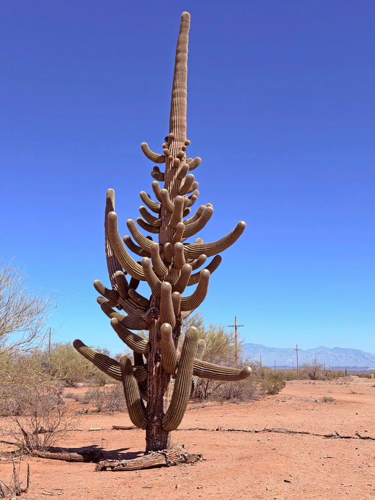
Another hot day, we took a drive out Avra Valley Road to the Ironwood Forest National Monument to see a spectacular saguaro. This saguaro has been named “Shiva” and reportedly has over eighty arms. A friend told us about it and we found out more information at the Friends of Ironwood Forest website. ( ironwoodforest.org ) The huge cactus can be seen from the road. There’s a parking area on the south side of the road, just past the second cattle guard. A circle of sticks surrounds the saguaro to help prevent its root structure from being damaged.
Part two of March 2026 in Arizona will likely be posted after the middle of April. We want to see as many new species of birds before we head north. The blog can wait.
