We were finally successful after several attempts at the lottery for a permit to the North Coyote Buttes and “The Wave.” The area is in the Paria Canyon-Vermilion Cliffs Wilderness and is managed by Bureau of Land Management. This actually was our second visit to the area. In 2022, we hiked to “The Wave” on a frigid, windy day. (See the previous blog post for Feb. 2022.) This time we were hoping for better weather and we also wanted to explore a bit beyond the famous section.
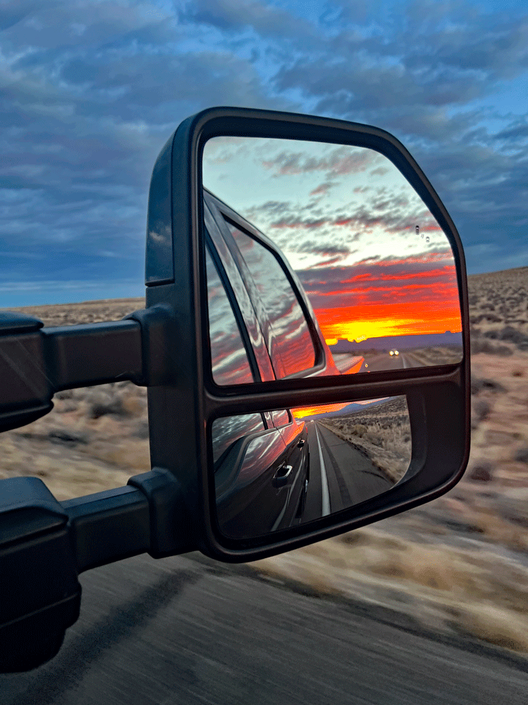
We left our hotel in Page just before 7 am. Since we were travelling west to Utah and the Wire Pass trailhead, our sunrise view was in our mirrors.
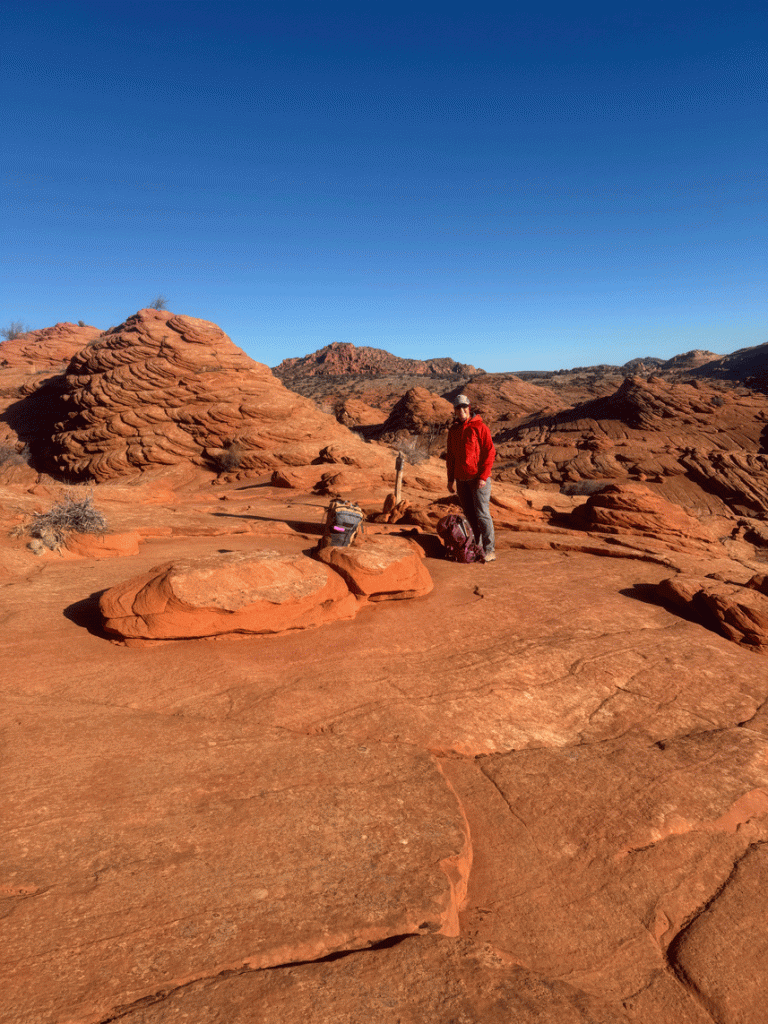
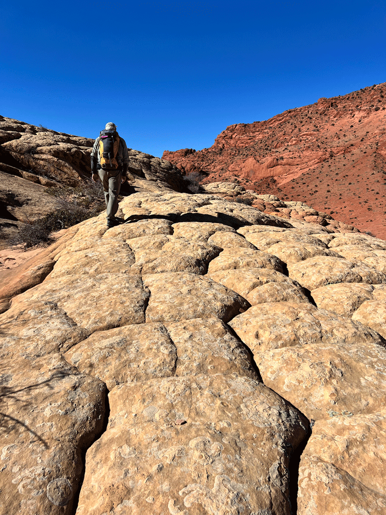
We left the parking lot just after 8. Within 35 minutes we had left the wash and sandy trail behind and were at on the rock at a small saddle. We were warm enough to take off a layer or two.
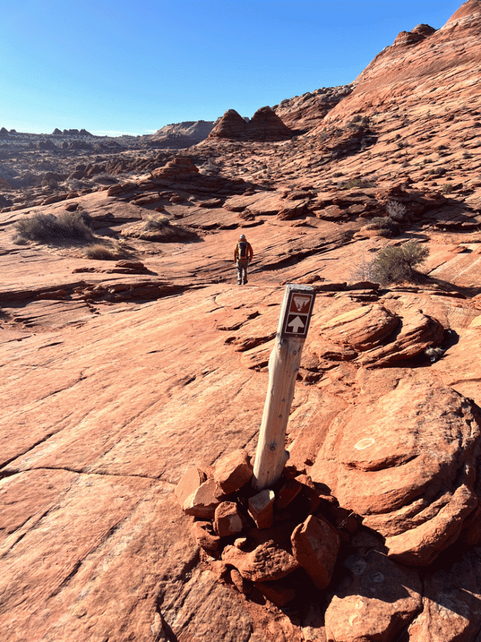
We chose our own route along the sandstone, since there were no permanent markers. There were a couple of posts like the one in the photo below which were more important on the way back. We headed to the right side of the Twin Buttes.
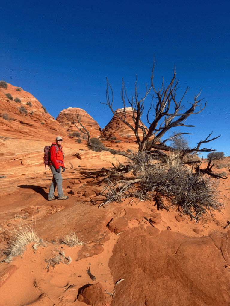
This dead juniper is also a good landmark. This photo is taken looking back to the Twin Buttes and shows the route we will take to the trailhead. At this point, we had been walking a little over an hour.
About twenty minutes later, we were descending and following footprints through the sand dunes.
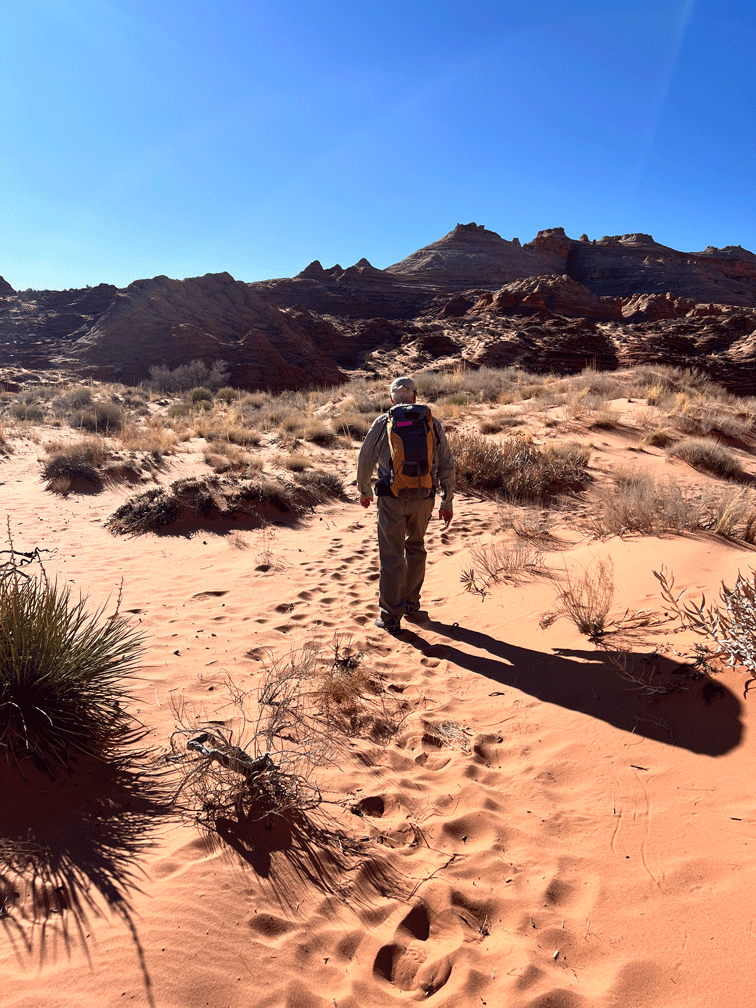
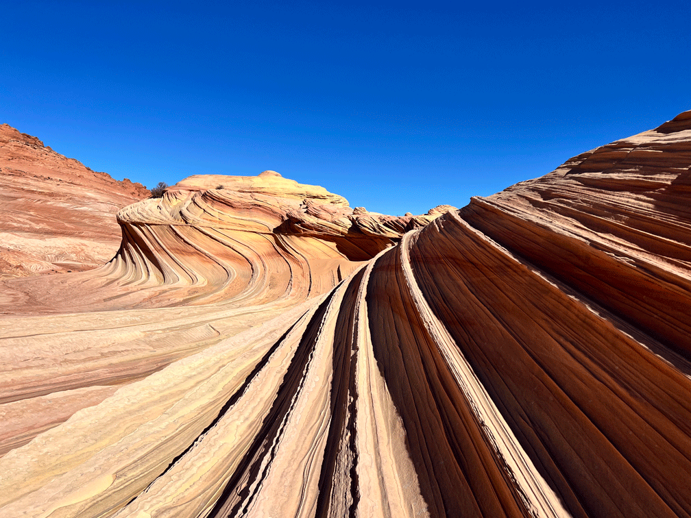
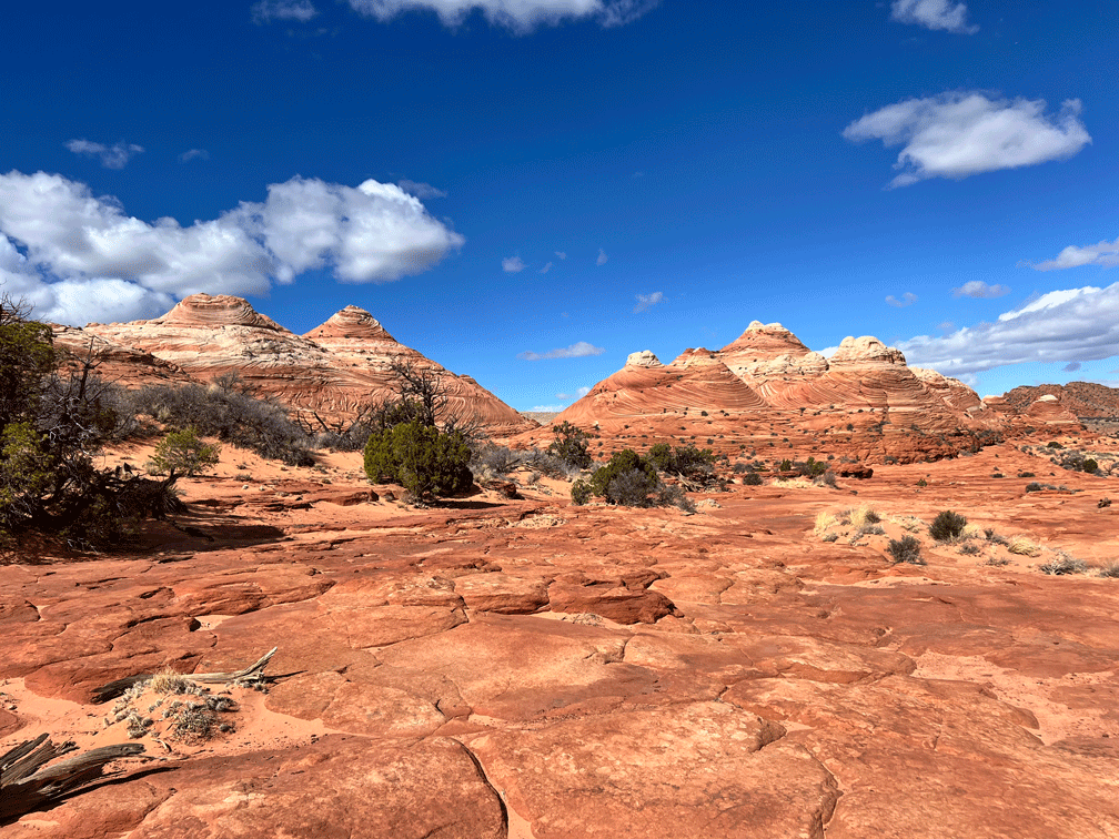
Soon we were working our way up to the rock formations that include and surround “The Wave.”
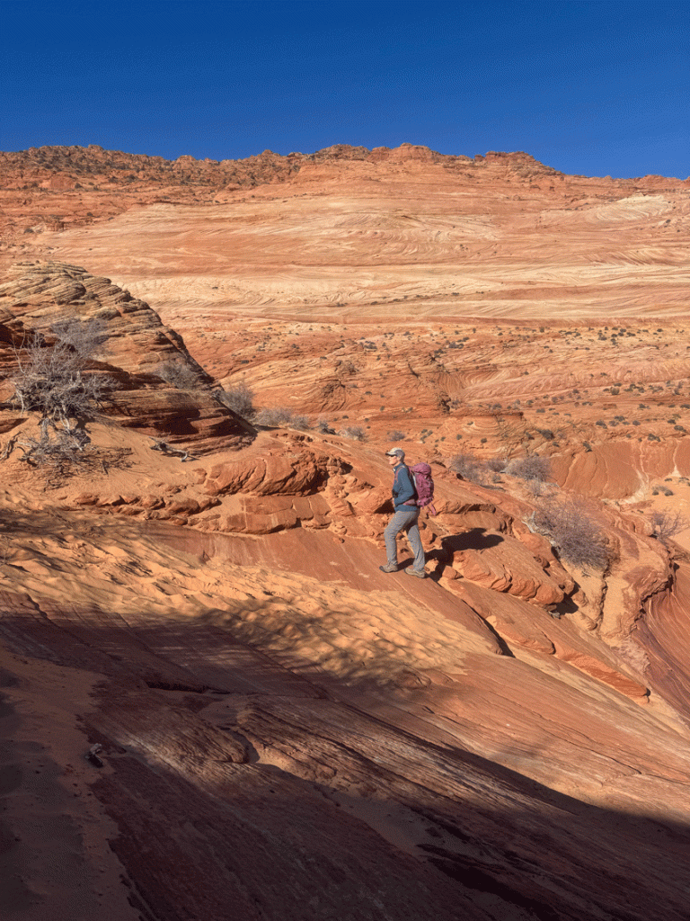
Getting closer!

Almost there!
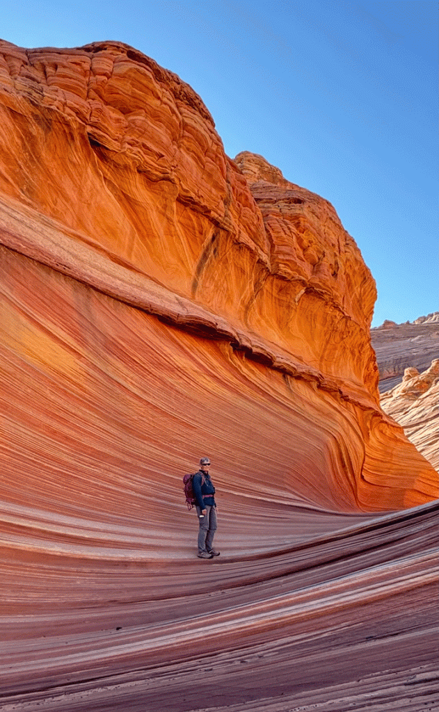
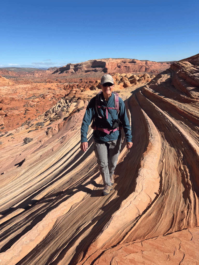
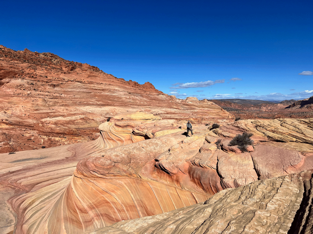
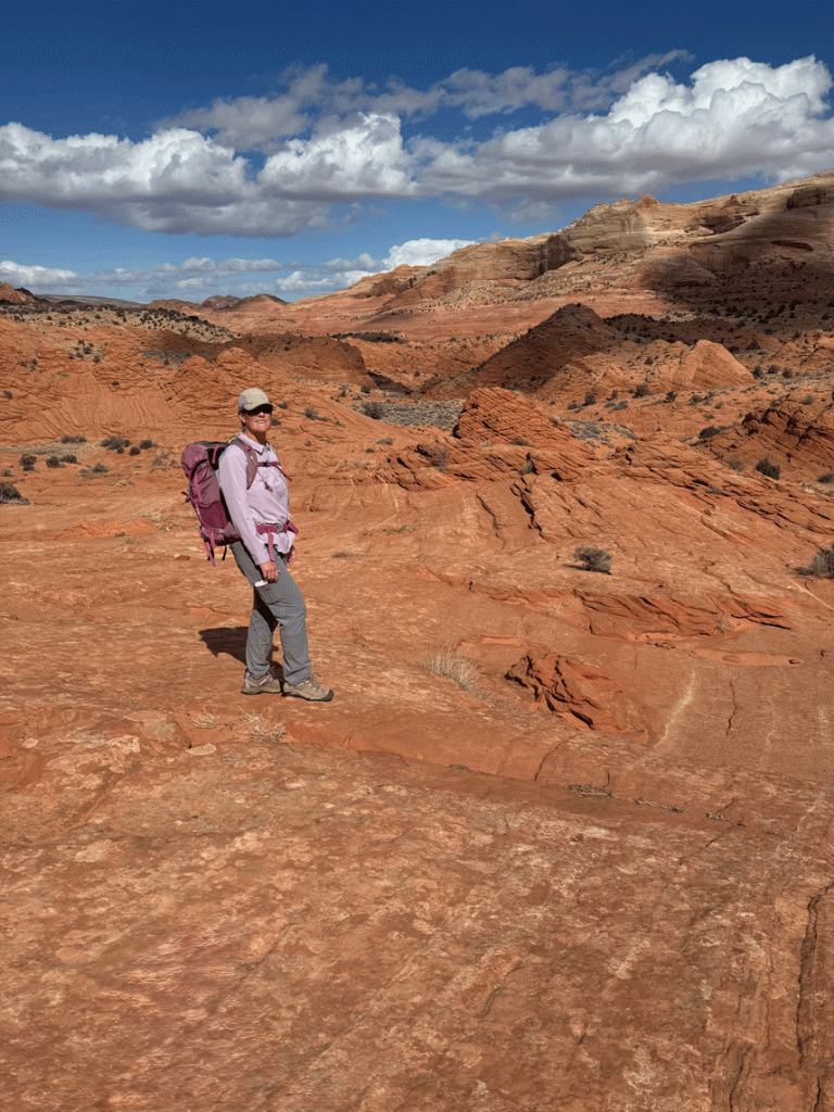
Wendy is half-way up “The Wave” in the photo below to give a sense of the scale.
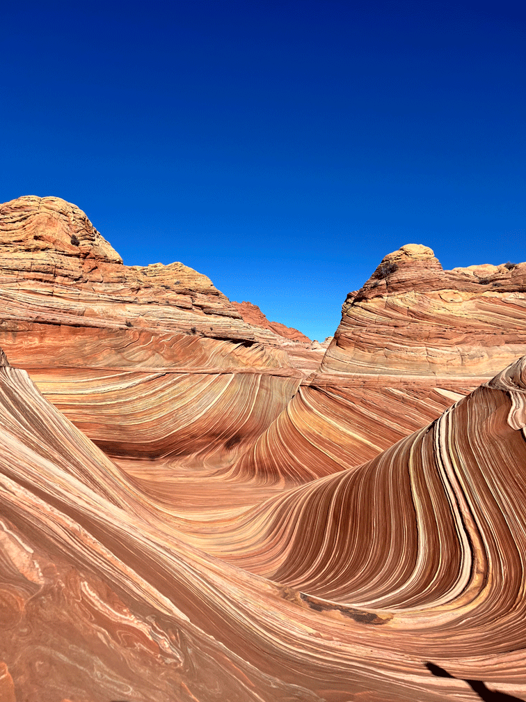
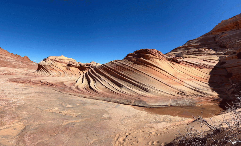
This was our first view of “The Wave” from a flat spot near the top just after 10 am.
We had a short break near there, then hiked angling gradually upwards. The erosion pattern on this slope made a sort of staircase.
This is our first view of the feature we think is referred to as the “Second Wave.”
We continued walking westward. Some of the rock looked like pillows.
This is the view looking down from the “pillow rocks” and across to “The Swirls.” There is a group of three people resting on the rocks near the sand. We met the guided group later. We walked a bit farther, until it dropped off, so we turned around.

This is our second view of the “Second Wave.” We followed our previous route back and climbed close to the shadow line in the photo below.
Doug stayed at the first flattish area and Wendy climbed up to the right, and took a photo looking down.
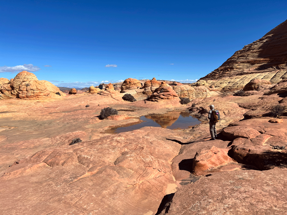
We had passed these puddles on our first exploration, but the light was better for a photo on our way back to the main “Wave” area.
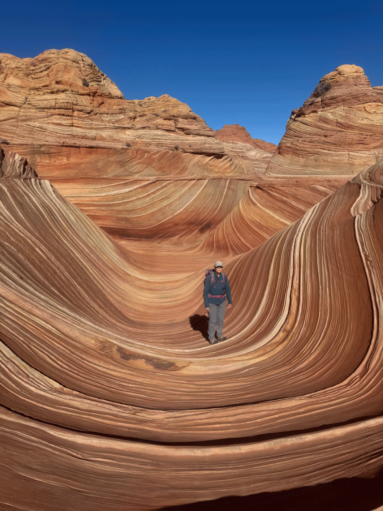
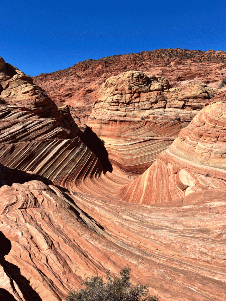
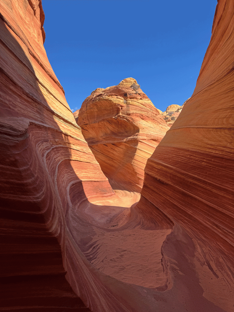
We descended to have another look at “The Wave.” We met some volunteers that were in a little alcove at about the same level that this photo was taken. They were checking for permits and matching the groups that they met with the vehicles in the parking lot. They had a satellite phone so they could contact “Dispatch” with updates and offer assistance to any group that was experiencing difficulty.
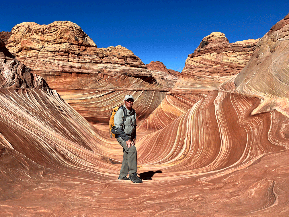
This seemed to be the standard place to have your photo taken with “The Wave” as a backdrop. Portrait view…
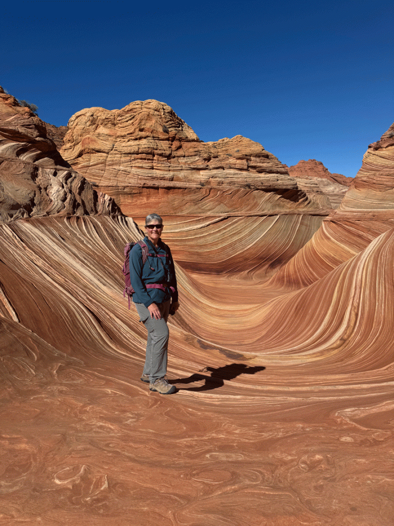
…and landscape view.
We headed up and to the right and around the corner, to look down one of the side gulleys and get a different perspective.
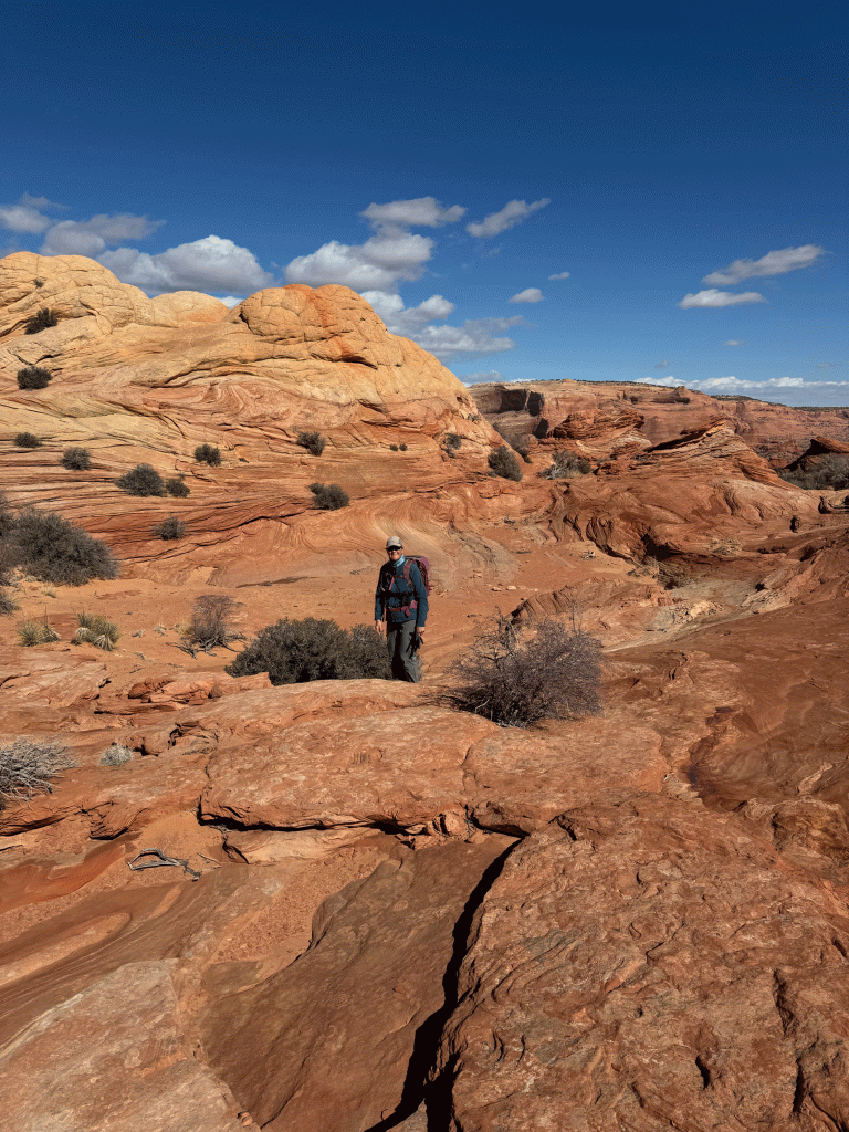
We had our lunch in a quiet spot to the east of the main area. It wasn’t “The Wave,” but it was pretty spectacular.
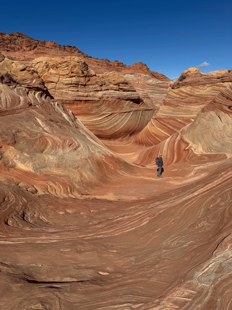
Then we made our final pass down through “The Wave.” Wendy crouched and leaned into one side wall for this angle.

At the bottom of the slope, we walked to the left canyon-like opening, for this view.
We followed our same route down to the sandy section and back up to the rock as we headed back to the trailhead. The photo below was taken at 12:30.

It’s obvious why the area was named the Coyote Buttes from this view looking south.
This photo was taken when we were almost off the rock and back to the sandy trail. We were comfortable hiking in shirtsleeves. The clouds were building up, and we had a drop or two of rain as we walked along the wash. We got back to the truck about 2. A fantastic day!
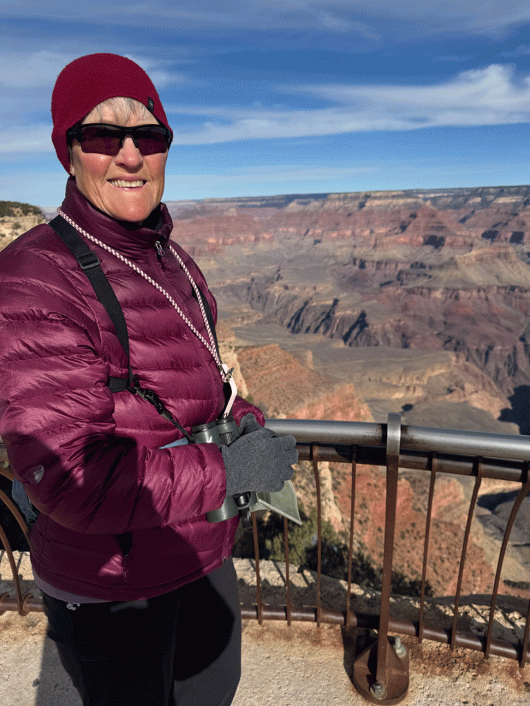
The next day, we added a couple of hours to our return trip to Tucson by driving to the Grand Canyon. We didn’t want to miss another opportunity to look at the awe-inspiring view.
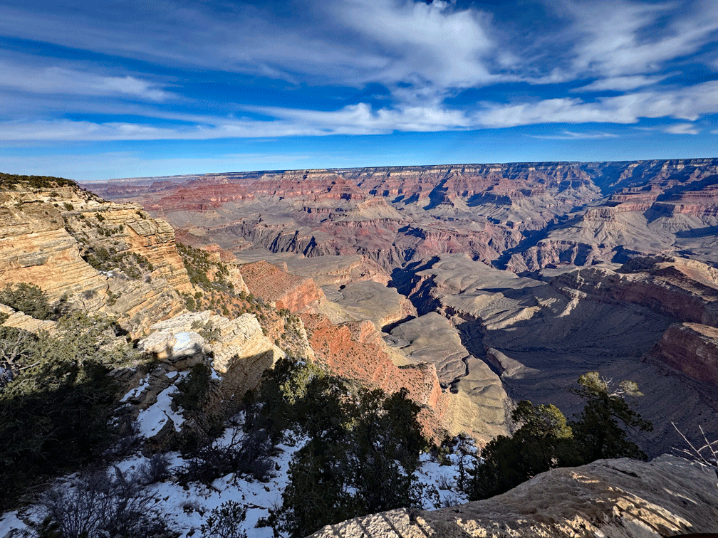
It was pretty windy and cold, however, so we didn’t stay long.
We drove out of the national park through the south entrance, then stopped in Camp Verde for lunch. We had time to buy groceries before we got back at our place by five.
We’re not likely to return to “The Wave,” so this time we took many photos and have included a selection of them here. “The Wave” first became famous because of a German documentary film and then became well-known to landscape photographers. In 2022, Doug took his SLR camera; this year all our photos were taken with Doug’s iPhone 15 Pro or Wendy’s iPhone 13 Pro. Perhaps this post will motivate you to apply for a permit and see “The Wave” for yourself.
There are plenty of bird photos in our next blog post: February in Arizona: Part 3: birding, to be published soon.

the wave is amazing. Thanks for sharing your experience.
LikeLike